Area Overview for CV1 4JG
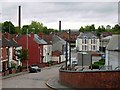
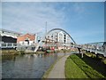
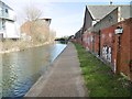
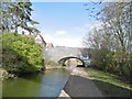
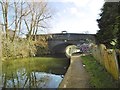
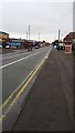
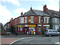
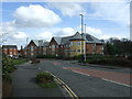
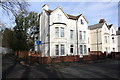
Photos of CV1 4JG


Area Information
Living in CV1 4JG means residing within Foleshill Ward, a specific postcode cluster located in the urban north of Coventry City. This small residential area forms part of a wider history that stretches back to the Domesday Book of 1086, originally recorded as Folks Hill. The land evolved from a rural parish known for ribbon weaving and coal mining into a built-up manufacturing district after being fully absorbed by Coventry in 1932. Today, the postcode covers a tight-knit community of approximately 1,500 people who rely on the A444 Foleshill Road and surrounding streets for daily movement. The local character is defined by its close proximity to historic landmarks like St Laurence's Church on Old Church Road and former industrial sites such as the Courtaulds factory. While the area bears the marks of its industrial past, including the restoration of social housing sites at Cash's Topshops, it functions now as a solid part of the West Midlands city fabric. Residents here navigate a landscape where modern housing blends with remnants of heathland geography found in names like Longford and Little Heath. Understanding this background helps you grasp the practicalities and potential of a home in this postcode, balancing the constraints of urban density with the historical weight of Foleshill.
- Area Type
- Postcode
- Area Size
- Not available
- Population
- 1500
- Population Density
- 7553 people/km²
Homes in CV1 4JG are primarily houses, which distinguishes this postcode from areas dominated by flats or detached estates. This predominance of houses offers a specific profile for buyers seeking traditional housing stock within the urban bounds of Coventry. The ownership picture reveals a market where renting is the standard, with only 39% of residents owning their homes. Consequently, you are likely to encounter a mix of privately rented properties and agreed sales, rather than a market saturated by owner-occupiers. As a small residential cluster, CV1 4JG does not contain a huge variety of property types, which can simplify your search but also limit options compared to wider catchments. The fact that nearly 60% of the population rents suggests a high turnover in the rental sector, while the 39% ownership rate indicates that those who do own often stay longer. If you are looking to purchase, you are entering a market where houses are the norm, appealing to those who value ground-floor or single-unit living within a city environment. The specific nature of the area as a small cluster means that pricing will closely follow the broader Coventry and Foleshill trends. Buyers should look at the immediate surroundings managed by Coventry City Council for valuation guides, as the small size of the postcode prevents deviation from the wider local market average. Understanding that stock consists mainly of houses helps you evaluate what you can find within this tight geographic boundary versus the more varied options found further afield.
House Prices in CV1 4JG
No properties found in this postcode.
Energy Efficiency in CV1 4JG
Daily life in CV1 4JG is shaped by practical amenities located within easy reach of the residential cluster. You have immediate access to three major supermarkets, including Tesco Coventry, Morrisons Daily, and Aldi Radford, ensuring you never stray far for groceries or essentials. Retail options are concentrated, with five notable shops serving the local population, providing a convenient hub for weekly shopping. For travel needs, the area is well-served by rail infrastructure with five stations nearby. Residents can alight at Canley Railway Station, Tile Hill Railway Station, or Coventry Arena Railway Station to reach destinations across the region. Coventry Airport offers two key departure points, facilitating easy air travel for work or holidays without needing to commute through the city centre first. These transport nodes are critical for maintaining a lifestyle that balances urban convenience with regional accessibility. Beyond shopping and transport, the area is defined by its historical and cultural markers. St Laurence's Church on Old Church Road stands as a focal point, guiding the architectural character of the Bell Green sector. Former industrial sites like the Lockhurst Lane Industrial Co-operative Society and Cash's Topshops shape the streetscape, reminding residents of the area's manufacturing legacy. This blend of retail, rail access, and historic landmarks creates a functional lifestyle where daily needs are met without excessive travel.
Amenities
Schools
| Rank | School | Type | Entry gender | Ages |
|---|
Explore more schools in this area
Go to Schools tabDemographics
The community within CV1 4JG reflects a stable and mature profile. The most common age group for residents is adults between 30 and 64 years, with a median age of 47 years. This demographic structure suggests a population that has settled rather than transiently flowing through the area. The area is notably diverse, with the Asian total group representing the predominant ethnic group within the local statistics. Housing tenure here is mixed, though leaning towards renting. Only 39% of households own their homes, indicating that nearly four out of every five people lease their properties. This high rate of renting often correlates with the diverse nature of the community and the specific needs of working professionals or families moving into the region. Almost all residents live in houses, which distinguishes the stock from the high-rise apartments found in other parts of Coventry. These figures paint a picture of an established residential zone where families and long-term tenants form the backbone of the neighbourhood. The age and diversity data point to a community that has adapted to industrial shifts while maintaining a traditional housing footprint. You should expect a neighbourhood where the majority of occupants are established through a mix of ownership and rental arrangements, reflecting the area's ongoing role in housing the wider Coventry population.
Household Size
Accommodation Type
Tenure
Ethnic Group
Religion
Household Composition
Age
Household Deprivation
NS-SEC
Explore more demographic insights in this area
Go to Demographics tabPlanning
Planning Constraints
- Flood RiskPremium
- Ramsar Wetland SitesPremium
- Area of Outstanding Natural BeautyPremium
- Protected Nature ReservePremium
- Protected WoodlandPremium