Area Overview for CV1 4HQ
Photos of CV1 4HQ
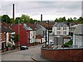


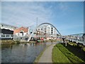
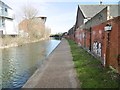
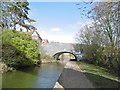

100 photos from this area
Area Information
Key information about the CV1 4HQ including its size, population, and administrative classification.
- Area Type
- Postcode
- Area Size
- 5366 m²
- Population
- 1500
- Population Density
- 7553 people/km²
House Prices in CV1 4HQ
32
Properties
£74,409
Average Sold Price
£15,000
Lowest Price
£170,000
Highest Price
Showing 32 properties
| Address | Type | Beds | Baths | Last Sale Price | Last Sale Date | |
|---|---|---|---|---|---|---|
| 19 Ena Road, Coventry, CV1 4HQ | Terraced | 4 | 2 | £160,000 | Jul 2022 | |
| 33 Ena Road, Coventry, CV1 4HQ | Semi-detached | 4 | 2 | £170,000 | Apr 2019 | |
| 2 Ena Road, Coventry, CV1 4HQ | Terraced | 4 | 1 | £110,000 | Dec 2018 | |
| 23 Ena Road, Coventry, CV1 4HQ | house | 1 | 2 | £104,000 | Mar 2013 | |
| 22 Ena Road, Coventry, CV1 4HQ | Terraced | - | - | £80,000 | Dec 2010 | |
| 1 Ena Road, Coventry, CV1 4HQ | Terraced | 1 | 1 | £55,000 | Oct 2009 | |
| 16 Ena Road, Coventry, CV1 4HQ | house | - | - | £55,000 | Oct 2009 | |
| 3 Ena Road, Coventry, CV1 4HQ | Terraced | 2 | 1 | £60,000 | Aug 2008 | |
| 25 Ena Road, Coventry, CV1 4HQ | Terraced | - | - | £109,950 | Jan 2005 | |
| 11 Ena Road, Coventry, CV1 4HQ | Terraced | 2 | 1 | £55,000 | Nov 2003 |
Page 1 of 4
Energy Efficiency in CV1 4HQ
Amenities
Schools
| Rank | School | Type | Entry gender | Ages |
|---|
Explore more schools in this area
Go to Schools tabDemographics
Household Size
Family (3-5 people)
most common
Accommodation Type
Houses
most common
Tenure
39
majority
Ethnic Group
asian_total
most common
Religion
N/A
most common
Household Composition
N/A
most common
Age
47
median
Adults (30-64 years)
most common
Household Deprivation
N/A
with no deprivation
NS-SEC
12
in Lower managerial occupations
Explore more demographic insights in this area
Go to Demographics tabPlanning
Planning Constraints
- Flood RiskPremium
- Ramsar Wetland SitesPremium
- Area of Outstanding Natural BeautyPremium
- Protected Nature ReservePremium
- Protected WoodlandPremium