Area Overview for CV1 3PF
Photos of CV1 3PF
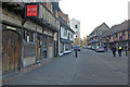
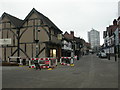
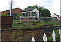
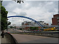
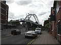
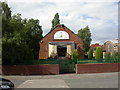
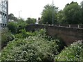
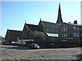
100 photos from this area
Area Information
Key information about the CV1 3PF including its size, population, and administrative classification.
- Area Type
- Postcode
- Area Size
- 7090 m²
- Population
- 1514
- Population Density
- 7425 people/km²
House Prices in CV1 3PF
8
Properties
£152,850
Average Sold Price
£60,000
Lowest Price
£252,500
Highest Price
Showing 8 properties
| Address | Type | Beds | Baths | Last Sale Price | Last Sale Date | |
|---|---|---|---|---|---|---|
| 108 Northumberland Road, Coventry, CV1 3PF | Semi-detached | 3 | 1 | £252,500 | Mar 2025 | |
| 98 Northumberland Road, Coventry, CV1 3PF | Terraced | 3 | 2 | £205,000 | Oct 2021 | |
| 100 Northumberland Road, Coventry, CV1 3PF | Terraced | 3 | 2 | £177,000 | Apr 2021 | |
| 102 Northumberland Road, Coventry, CV1 3PF | Terraced | 1 | 1 | £139,950 | Oct 2018 | |
| 110 Northumberland Road, Coventry, CV1 3PF | Semi-detached | 3 | 1 | £162,500 | Mar 2006 | |
| 104 Northumberland Road, Coventry, CV1 3PF | Terraced | - | - | £73,000 | Feb 2000 | |
| 106 Northumberland Road, Coventry, CV1 3PF | Semi-detached | - | - | £60,000 | Sep 1998 | |
| 96 Northumberland Road, Coventry, CV1 3PF | Terraced | 3 | 2 | - | - |
Energy Efficiency in CV1 3PF
Amenities
Schools
| Rank | School | Type | Entry gender | Ages |
|---|
Explore more schools in this area
Go to Schools tabDemographics
Household Size
One person
most common
Accommodation Type
Houses
most common
Tenure
26
majority
Ethnic Group
White
most common
Religion
N/A
most common
Household Composition
N/A
most common
Age
47
median
Adults (30-64 years)
most common
Household Deprivation
N/A
with no deprivation
NS-SEC
19
in Lower managerial occupations
Explore more demographic insights in this area
Go to Demographics tabPlanning
Planning Constraints
- Flood RiskPremium
- Ramsar Wetland SitesPremium
- Area of Outstanding Natural BeautyPremium
- Protected Nature ReservePremium
- Protected WoodlandPremium