Area Overview for CV1 3HL
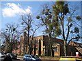
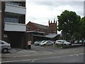
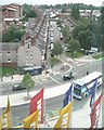
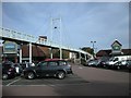
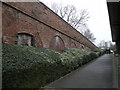
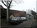
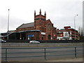
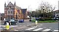
Photos of CV1 3HL


Area Information
Living in CV1 3HL means residing within the Sherbourne Ward, a small residential cluster in the heart of Coventry. This specific postcode covers an area of just 2685 square metres, housing a population of 1538 people. The location sits near the River Sherbourne, a waterway that has defined the local landscape for over a thousand years. Historically, the river served as a moat for the city's medieval walls and later required significant drainage improvements under the Public Health Act in 1849 to manage regular flooding. Today, the area retains historical significance near Coventry Priory grounds and Whitefriars, offering residents a connection to the city's rich past while living in a developed urban environment. The density here is exceptionally high, with over 570,000 people per square kilometre across the ward, reflecting the compact nature of this Coventry postcode. You are stepping into a space where modern city life meets centuries of engineering and history, distinct from the quieter outskirts of the West Midlands.
- Area Type
- Postcode
- Area Size
- 2685 m²
- Population
- 1538
- Population Density
- 9728 people/km²
Homes in CV1 3HL are characterised by a specific housing stock: flats. This indicates a rental-heavy market rather than a traditional owner-occupier street. Only 16% of households own their homes, meaning 84% of residents rely on the private or social rental sector. For buyers looking at this micro-area and its immediate surroundings, this implies that purchasing a property directly within the CV1 3HL postcode may be difficult, as the demand often leans towards tenancy. The accommodation consists primarily of flats, which are suited to single professionals, couples, or small families seeking convenience in a city centre location. This property mix contrasts with suburban areas where detached houses or semi-detached properties dominate. Potential owners should consider the availability of houses in the wider Sherbourne Ward, as this specific cluster functions more as a high-density living zone than a traditional residential suburb with freehold homes.
House Prices in CV1 3HL
Showing 54 properties
| Address | Type | Beds | Baths | Last Sale Price | Last Sale Date | |
|---|---|---|---|---|---|---|
| 3, Givens House, Vincent Street, Coventry, CV1 3HL | Flat | - | - | - | - | |
| 12, Givens House, Vincent Street, Coventry, CV1 3HL | Flat | - | - | - | - | |
| 10, Givens House, Vincent Street, Coventry, CV1 3HL | Flat | - | - | - | - | |
| 44, Givens House, Vincent Street, Coventry, CV1 3HL | Maisonette | - | - | - | - | |
| 6, Givens House, Vincent Street, Coventry, CV1 3HL | Flat | - | - | - | - | |
| 28, Givens House, Vincent Street, Coventry, CV1 3HL | Flat | - | - | - | - | |
| 41, Givens House, Vincent Street, Coventry, CV1 3HL | Maisonette | - | - | - | - | |
| 15, Givens House, Vincent Street, Coventry, CV1 3HL | Flat | - | - | - | - | |
| 39, Givens House, Vincent Street, Coventry, CV1 3HL | Maisonette | - | - | - | - | |
| 51, Givens House, Vincent Street, Coventry, CV1 3HL | Flat | - | - | - | - |
Energy Efficiency in CV1 3HL
Daily life in CV1 3HL benefits from immediate access to a range of amenities. Within practical reach, you will find five retail outlets, including Iceland Coventry, Aldi Unit 8 & 9 Central, and Tesco Coventry. These supermarkets provide essential shopping needs without requiring long travel distances. Transport links are equally extensive, with five rail stations nearby serving as key interchange points. Canley and Coventry Arena Railway Stations offer frequent services, while Tile Hill provides an alternative hub. Beyond rail, the area enjoys proximity to two locations near Coventry Airport, highlighting the region's dual focus on community transport and air connectivity. This concentration of services means you can handle daily errands, grocery shopping, and commuting from this small residential cluster without departing the greater Coventry urban area. The presence of these major retailers and transport nodes defines the convenient, self-contained lifestyle available here.
Amenities
Schools
Families considering homes in CV1 3HL have access to specific educational options nearby. The area is served by Spon Gate Primary School, which operates as a primary school. The school holds a 'good' Ofsted rating, providing a reassuring standard of education for young children. Currently, the data lists only primary institutions in the immediate vicinity of this postcode. This means that while primary education is well-represented, prospective parents with older children may need to look beyond the immediate street range for secondary school options. The presence of a 'good' rated primary school is a positive factor for those establishing a household here, yet the absence of listed secondary schools in the dataset suggests that mixing schools or travelling to other wards may be necessary for high school education.
| Rank | School | Type | Entry gender | Ages |
|---|
Explore more schools in this area
Go to Schools tabDemographics
The community in CV1 3HL is dominated by adults aged between 30 and 64 years, with a median age of 47. This age profile suggests a neighbourhood consisting largely of established households rather than a transient student population. Home ownership stands at 16%, indicating that the vast majority of residents likely rent their properties. The predominant accommodation type in this postcode area is flats, which aligns with the high population density and urban setting. The demographic composition is predominantly White, reflecting the broader character of Coventry. While specific data on deprivation levels is not provided in the current dataset, the low home ownership rate and prevalence of rental flats often correlate with diverse living situations typical of dense city wards. Residents here represent a mature demographic living in high-density flats, a common arrangement in central Coventry where space is at a premium.
Household Size
Accommodation Type
Tenure
Ethnic Group
Religion
Household Composition
Age
Household Deprivation
NS-SEC
Explore more demographic insights in this area
Go to Demographics tabPlanning
Planning Constraints
- Flood RiskPremium
- Ramsar Wetland SitesPremium
- Area of Outstanding Natural BeautyPremium
- Protected Nature ReservePremium
- Protected WoodlandPremium