Area Overview for CV1 2TH
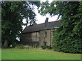
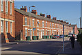
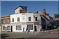
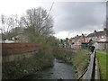
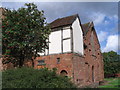
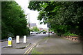
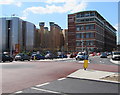
Photos of CV1 2TH


Area Information
CV1 2TH is a small residential postcode area in England with a population of 2094, characterised by a compact cluster of homes. The area is predominantly inhabited by young adults aged 15–29, reflecting a dynamic, youthful community. With 37% of residents owning their homes and the rest likely renting, the area balances owner-occupied properties with rental stock. The housing stock consists mainly of houses rather than flats, suggesting a focus on family-friendly or semi-detached living. Proximity to All Saints Church of England Primary School, rated ‘good’ by Ofsted, makes it appealing for families. Digital connectivity is strong, with a broadband score of 100 and mobile coverage of 85, supporting remote work and daily internet use. While flood risk is low, the area carries a medium crime risk, requiring standard security measures. Transport options include multiple railway stations and nearby airports, offering connectivity to Coventry and beyond. The mix of amenities, from retail outlets to rail links, supports a practical, accessible lifestyle.
- Area Type
- Postcode
- Area Size
- Not available
- Population
- 2094
- Population Density
- 8130 people/km²
The property market in CV1 2TH is defined by a 37% home ownership rate, indicating a majority rental market. The area’s housing stock consists primarily of houses, which contrasts with higher-density areas dominated by flats or apartments. This suggests a focus on semi-detached or terraced homes, likely appealing to families or individuals seeking more space. The small size of the postcode area means the housing stock is limited, potentially creating competition for available properties. For buyers, the mix of rental and owner-occupied homes could imply a mix of long-term residents and transient occupants. The lack of detailed data on property prices or types means the market’s affordability or investment potential remains unclear. However, the presence of nearby amenities and transport links may enhance the area’s appeal for those prioritising convenience over property value speculation.
House Prices in CV1 2TH
No properties found in this postcode.
Energy Efficiency in CV1 2TH
Residents of CV1 2TH have access to a range of practical amenities within reach. Retail options include Sainsburys Coventry, Co-op Coventry, and Spar, providing everyday shopping convenience. The area’s rail network, with stations like Canley and Tile Hill, connects to Coventry and beyond, facilitating commuting or leisure travel. While no specific parks or leisure facilities are listed, the proximity to rail and retail hubs suggests a lifestyle focused on accessibility. The presence of multiple retail outlets and transport links indicates a community prioritising convenience over expansive recreational spaces. For those seeking a balance between urban and suburban living, the area’s amenities cater to daily needs without requiring long commutes. The mix of shops, transport, and nearby schools supports a functional, practical lifestyle.
Amenities
Schools
The primary school nearest to CV1 2TH is All Saints Church of England Primary School, which holds a ‘good’ Ofsted rating. This school serves the local community, offering education for younger children and contributing to the area’s family-friendly appeal. The absence of secondary schools in the immediate vicinity may require families to consider nearby areas for secondary education, though the proximity to Coventry’s rail network could ease commuting. The presence of a well-rated primary school is a key draw for families, though the lack of higher education facilities within the postcode itself may influence housing decisions. The school’s rating reflects its ability to meet educational standards, which is critical for prospective buyers prioritising quality schooling for their children.
| Rank | School | Type | Entry gender | Ages |
|---|
Explore more schools in this area
Go to Schools tabDemographics
CV1 2TH has a median age of 22, with the majority of residents aged 15–29, indicating a young, possibly transient population. Home ownership stands at 37%, suggesting a significant proportion of renters, which may reflect student or young professional demographics. The accommodation type is predominantly houses, aligning with the area’s residential character. The predominant ethnic group is White, though no further diversity data is provided. This age profile and ownership rate imply a community focused on affordability and flexibility, potentially attracting students or those in early careers. The relatively low home ownership rate may also indicate a reliance on rental markets or shared living arrangements. The absence of detailed deprivation data means the quality of life implications of these figures remain unquantified, though the youthful demographic and proximity to amenities suggest a vibrant, service-oriented environment.
Household Size
Accommodation Type
Tenure
Ethnic Group
Religion
Household Composition
Age
Household Deprivation
NS-SEC
Explore more demographic insights in this area
Go to Demographics tabPlanning
Planning Constraints
- Flood RiskPremium
- Ramsar Wetland SitesPremium
- Area of Outstanding Natural BeautyPremium
- Protected Nature ReservePremium
- Protected WoodlandPremium