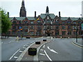
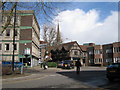
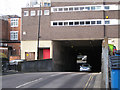
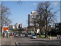
Area Overview for CV1 2PT
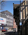
Photos of CV1 2PT


Area Information
CV1 2PT is a small residential postcode area in England, home to 2,774 residents. It is a compact cluster of homes, primarily occupied by young adults aged 15–29, reflecting a dynamic, youthful community. The area’s proximity to key amenities and transport links makes it accessible for those seeking convenience without sacrificing space. Nearby, independent schools such as Cheshunt School and Rathbone Choices cater to families, while multiple railway stations, including Canley and Tile Hill, provide easy access to Coventry and beyond. Digital connectivity is strong, with a broadband score of 95 and mobile coverage at 85, supporting both remote work and daily internet use. However, the area’s small size means it is tightly knit, with limited green spaces or natural features. For buyers, this postcode offers a blend of practicality and modern infrastructure, though the high crime risk score of 32 suggests caution in assessing personal safety needs.
- Area Type
- Postcode
- Area Size
- Not available
- Population
- 2774
- Population Density
- 3470 people/km²
The property market in CV1 2PT is defined by its small size and focus on houses rather than flats. With 46% of homes owned by residents, the area is not heavily reliant on rental demand, though the limited number of properties suggests a constrained market. The predominance of houses indicates a preference for standalone living, which may appeal to families or individuals seeking space. However, the small postcode area means that buyers must consider the broader surrounding region for more options. The lack of specific data on property prices or recent sales trends means that market dynamics are not fully quantified. For those seeking homes here, the compact nature of the area may necessitate a broader search, balancing proximity to amenities with the availability of suitable properties.
House Prices in CV1 2PT
No properties found in this postcode.
Energy Efficiency in CV1 2PT
The lifestyle in CV1 2PT is shaped by its proximity to retail and transport hubs. Nearby shops include Spar, Tesco Coventry, and M&S Coventry Rail SF, offering a range of everyday essentials. The area’s rail stations, such as Canley and Tile Hill, provide access to Coventry’s cultural and commercial centres, while the nearby airports facilitate travel beyond the region. Though the data does not mention parks or leisure facilities, the presence of multiple retail and transport options suggests a practical, convenience-driven lifestyle. The compact nature of the area means that amenities are within walking or short driving distance, though the lack of green spaces or recreational facilities may be a drawback for those prioritising outdoor activities.
Amenities
Schools
The nearest schools to CV1 2PT include Cheshunt School and Rathbone Choices, both of which are independent institutions. These schools are likely to cater to a range of educational needs, though no Ofsted ratings or academic performance data are provided. The presence of independent schools suggests a focus on private education, which may be a key consideration for families prioritising specific curricula or facilities. However, the absence of state schools in the immediate vicinity could limit options for those seeking public education. The small size of the area means that families may need to look beyond CV1 2PT for a broader selection of schools, particularly if they require state-funded options.
| Rank | School | Type | Entry gender | Ages |
|---|
Explore more schools in this area
Go to Schools tabDemographics
The population of CV1 2PT is predominantly young, with a median age of 22 and the majority of residents aged 15–29. Home ownership stands at 46%, indicating a mix of owner-occupied properties and rental units. The area is characterised by houses rather than flats, reflecting a preference for standalone living. The predominant ethnic group is White, though no specific data on diversity or deprivation levels is available. The youth demographic suggests a community focused on education, employment, and early career development. With a population of 2,774, the area is small enough to foster a close-knit environment but limited in scale to offer extensive social or cultural amenities. This profile may appeal to young professionals or students seeking affordability and proximity to services, though the lack of detailed diversity metrics leaves gaps in understanding the full community composition.
Household Size
Accommodation Type
Tenure
Ethnic Group
Religion
Household Composition
Age
Household Deprivation
NS-SEC
Explore more demographic insights in this area
Go to Demographics tabPlanning
Planning Constraints
- Flood RiskPremium
- Ramsar Wetland SitesPremium
- Area of Outstanding Natural BeautyPremium
- Protected Nature ReservePremium
- Protected WoodlandPremium