Area Overview for CV1 2LE
Photos of CV1 2LE
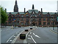
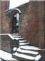
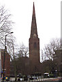

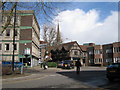

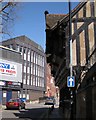
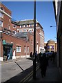
100 photos from this area
Area Information
Key information about the CV1 2LE including its size, population, and administrative classification.
- Area Type
- Postcode
- Area Size
- 2.0 hectares
- Population
- 2774
- Population Density
- 3470 people/km²
House Prices in CV1 2LE
31
Properties
£340,677
Average Sold Price
£97,000
Lowest Price
£740,000
Highest Price
Showing 31 properties
| Address | Type | Beds | Baths | Last Sale Price | Last Sale Date | |
|---|---|---|---|---|---|---|
| 39 Park Road, Coventry, CV1 2LE | house | - | - | £420,000 | Jul 2022 | |
| Athens House, 11 Park Road, Coventry, CV1 2LE | house | - | - | £740,000 | Nov 2020 | |
| 41 Park Road, Coventry, CV1 2LE | house | 2 | 2 | £202,500 | Sep 2019 | |
| 19 Park Road, Coventry, CV1 2LE | Semi-detached | 1 | 1 | £600,000 | Dec 2017 | |
| 29 Park Road, Coventry, CV1 2LE | Detached | 5 | 3 | £351,594 | Aug 2017 | |
| 43 Park Road, Coventry, CV1 2LE | Flat | 1 | 1 | £97,000 | Dec 2014 | |
| 45 Park Road, Coventry, CV1 2LE | Flat | 30 | 30 | £105,000 | Mar 2014 | |
| 9 Park Road, Coventry, CV1 2LE | Flat | 1 | 1 | £425,000 | Oct 2007 | |
| 25 Park Road, Coventry, CV1 2LE | Detached | - | - | £125,000 | Jun 2002 | |
| Flat Above, 11 Park Road, Coventry, CV1 2LE | Detached | 14 | 1 | - | - |
Page 1 of 4
Energy Efficiency in CV1 2LE
Amenities
Schools
| Rank | School | Type | Entry gender | Ages |
|---|
Explore more schools in this area
Go to Schools tabDemographics
Household Size
One person
most common
Accommodation Type
Houses
most common
Tenure
46
majority
Ethnic Group
White
most common
Religion
N/A
most common
Household Composition
N/A
most common
Age
22
median
Young Adults (15-29 years)
most common
Household Deprivation
N/A
with no deprivation
NS-SEC
25
in Lower managerial occupations
Explore more demographic insights in this area
Go to Demographics tabPlanning
Planning Constraints
- Flood RiskPremium
- Ramsar Wetland SitesPremium
- Area of Outstanding Natural BeautyPremium
- Protected Nature ReservePremium
- Protected WoodlandPremium