Area Overview for CV1 2GJ
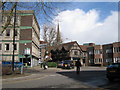
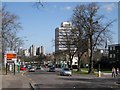
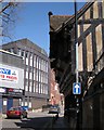
Photos of CV1 2GJ


Area Information
Living in CV1 2GJ means being part of a small, tightly knit residential cluster with a population of 2,774. This area is characterised by its youthful demographic, with nearly half the population aged between 15 and 29. The presence of independent schools like Cheshunt School and Rathbone Choices suggests a focus on private education, appealing to families seeking alternative schooling options. The area’s compact size means amenities are within practical reach, including multiple rail stations and retail outlets. However, the high crime risk score of 32 indicates safety is a concern, requiring residents to take additional precautions. Despite this, the area enjoys excellent broadband connectivity (95/100) and proximity to Coventry Airport, making it suitable for commuters or those reliant on digital infrastructure. The low flood risk and absence of environmental constraints like AONB or protected woodlands suggest a relatively straightforward planning environment. For buyers, the mix of houses and rental properties, combined with a young population, points to a dynamic but evolving community.
- Area Type
- Postcode
- Area Size
- Not available
- Population
- 2774
- Population Density
- 3470 people/km²
The property market in CV1 2GJ is dominated by houses, with 46% of residents owning their homes. This suggests a mix of owner-occupied properties and rental units, though the lower home ownership rate indicates a significant portion of the housing stock is available for rent. The presence of houses rather than flats or apartments may cater to families or individuals seeking more space, but the small area size means the market is likely limited in volume. Buyers should consider the area’s proximity to rail links and retail hubs, which could enhance property value for those prioritising connectivity. However, the high crime risk score of 32 may impact desirability, particularly for families. Given the youthful demographic, properties here may appeal to students or young professionals, though the lack of detailed data on property prices or development trends means potential buyers should conduct further local investigations.
House Prices in CV1 2GJ
No properties found in this postcode.
Energy Efficiency in CV1 2GJ
Residents of CV1 2GJ have access to a range of amenities within walking or short driving distance. Retail options include Sainsburys Coventry, M&S Coventry Rail SF, and Aldi Unit 8 & 9 Central, offering everyday shopping needs. The rail network is well-served, with five stations providing links to Coventry and beyond, enhancing connectivity for commuters. The presence of two airports nearby, both named Coventry Airport, may be beneficial for frequent travellers. However, the data does not specify parks, leisure facilities, or dining options, meaning the area’s lifestyle offerings are not fully detailed. The compact nature of the area suggests a focus on convenience over expansive recreational spaces, though the rail and retail access supports a practical, urban lifestyle.
Amenities
Schools
Residents of CV1 2GJ have access to two independent schools: Cheshunt School and Rathbone Choices. Both are private institutions, offering alternative education pathways outside the state system. The presence of independent schools may attract families seeking specific curricula, extracurricular opportunities, or smaller class sizes. However, no Ofsted ratings or academic performance data are provided, so prospective parents would need to conduct their own research into the quality of education. The mix of independent schools suggests a community prioritising private education, though it may exclude those seeking state-funded options. For families reliant on local state schools, this area may not be ideal, and additional travel could be necessary.
| Rank | School | Type | Entry gender | Ages |
|---|
Explore more schools in this area
Go to Schools tabDemographics
CV1 2GJ has a median age of 22, with the majority of residents aged between 15 and 29. This youthful profile suggests a community skewed towards students, young professionals, or those in early careers. Home ownership rates here are 46%, below the national average, indicating a higher proportion of renters. The predominant accommodation type is houses, which may reflect a preference for family-friendly living or larger spaces. The predominant ethnic group is White, though specific diversity metrics are not provided. With a population of 2,774, the area is small enough to foster a close-knit community but limited in scale. The age distribution implies a transient population, potentially influenced by nearby educational institutions or employment hubs. This profile may appeal to those seeking affordability or proximity to amenities, though the high crime risk score of 32 could deter some buyers.
Household Size
Accommodation Type
Tenure
Ethnic Group
Religion
Household Composition
Age
Household Deprivation
NS-SEC
Explore more demographic insights in this area
Go to Demographics tabPlanning
Planning Constraints
- Flood RiskPremium
- Ramsar Wetland SitesPremium
- Area of Outstanding Natural BeautyPremium
- Protected Nature ReservePremium
- Protected WoodlandPremium