Area Overview for CV1 2GH
Photos of CV1 2GH


Area Information
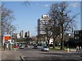
CV1 2GH is a small residential postcode area in England, home to approximately 2,774 people. It is a compact cluster of homes, predominantly houses, catering to a young demographic. The median age of 22 reflects a community largely composed of young adults aged 15–29, suggesting a dynamic, possibly student or early-career population. While the area lacks extensive historical or cultural details in official records, its proximity to Coventry’s rail network and retail hubs indicates practical connectivity for daily life. Residents benefit from nearby independent schools and multiple railway stations, which may support both commuting and access to urban amenities. The low flood risk and absence of environmental constraints like protected woodlands or AONBs suggest a relatively straightforward planning landscape. However, the area’s small size means it is tightly integrated with surrounding neighbourhoods, requiring buyers to consider broader regional factors when evaluating living in CV1 2GH.
- Area Type
- Postcode
- Area Size
- Not available
- Population
- 2774
- Population Density
- 3470 people/km²
The property market in CV1 2GH is defined by a 46% home ownership rate, suggesting a rental market that outpaces owner-occupation. The area’s housing stock is predominantly houses, which may appeal to families or individuals seeking more space than typical flats. However, the low home ownership percentage implies limited long-term investment potential for buyers, as the area may attract renters rather than those seeking to build equity. The small size of CV1 2GH means property choices are limited, requiring buyers to look beyond immediate surroundings. The presence of nearby rail stations could enhance the area’s appeal for commuters, but the lack of detailed data on property prices or trends means buyers must consider broader Coventry market dynamics when assessing homes in CV1 2GH.
House Prices in CV1 2GH
No properties found in this postcode.
Energy Efficiency in CV1 2GH
Residents of CV1 2GH have access to a range of amenities within walking or short driving distance. Retail options include M&S Coventry Rail SF, Sainsburys Coventry, and Aldi Unit 8 & 9 Central, providing everyday shopping needs. The rail network is a key feature, with stations like Tile Hill and Coventry Arena offering links to employment hubs and cultural centres. While the area lacks detailed information on parks or leisure facilities, its proximity to Coventry’s urban core suggests access to larger recreational spaces. The combination of retail outlets and rail connectivity creates a practical lifestyle, supporting both convenience and mobility. However, buyers should investigate further for specifics on local parks or community amenities not explicitly listed in the data.
Amenities
Schools
Residents of CV1 2GH have access to two independent schools: Cheshunt School and Rathbone Choices. Both institutions fall under the independent sector, which typically offers fee-based education and may cater to specific academic or extracurricular preferences. While no Ofsted ratings are provided, independent schools often prioritise smaller class sizes and specialised programmes. Families seeking such options may find these schools advantageous, though the absence of state-run schools in the data suggests a limited range of educational choices. Parents should consider whether independent schooling aligns with their budget and educational goals, as these institutions do not fall under the state-funded system.
| Rank | School | Type | Entry gender | Ages |
|---|---|---|---|---|
| 1 | Cheshunt School | independent | N/A | N/A |
| 2 | Rathbone Choices | independent | N/A | N/A |
Explore more schools in this area
Go to Schools tabDemographics
The population of CV1 2GH is characterised by a median age of 22, with the majority of residents falling within the 15–29 age range. This suggests a community skewed towards young adults, potentially including students or early-career professionals. Home ownership stands at 46%, below the national average, indicating a significant proportion of residents may be renting. The accommodation type is predominantly houses, which aligns with a lower density of flats or apartments. The predominant ethnic group is White, though no specific diversity statistics are provided. The young age profile may influence local amenities and services, with a focus on education and employment opportunities. For buyers, this demographic suggests a market potentially driven by transient populations or those seeking affordable housing in proximity to transport links.
Household Size
Accommodation Type
Tenure
Ethnic Group
Religion
Household Composition
Age
Household Deprivation
NS-SEC
Explore more demographic insights in this area
Go to Demographics tabPlanning
Planning Constraints
- Flood RiskPremium
- Ramsar Wetland SitesPremium
- Area of Outstanding Natural BeautyPremium
- Protected Nature ReservePremium
- Protected WoodlandPremium
- Crime RiskPremium