Area Overview for CV1 2DE
Photos of CV1 2DE
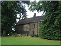
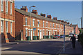
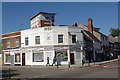

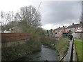
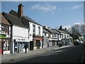

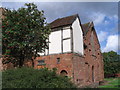
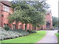
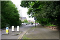
100 photos from this area
Area Information
Key information about the CV1 2DE including its size, population, and administrative classification.
- Area Type
- Postcode
- Area Size
- 9251 m²
- Population
- 2044
- Population Density
- 5842 people/km²
House Prices in CV1 2DE
50
Properties
£148,578
Average Sold Price
£34,248
Lowest Price
£440,000
Highest Price
Showing 50 properties
| Address | Type | Beds | Baths | Last Sale Price | Last Sale Date | |
|---|---|---|---|---|---|---|
| 53 Welland Road, Coventry, CV1 2DE | Terraced | 3 | 1 | £177,500 | Mar 2024 | |
| 27 Welland Road, Coventry, CV1 2DE | house | - | - | £176,000 | Apr 2023 | |
| 20 Welland Road, Coventry, CV1 2DE | Terraced | 6 | 2 | £375,000 | Mar 2023 | |
| 14 Welland Road, Coventry, CV1 2DE | Terraced | 3 | 1 | £195,000 | Mar 2023 | |
| 16 Welland Road, Coventry, CV1 2DE | house | 3 | 1 | £200,000 | Jan 2023 | |
| 49 WELLAND ROAD, Coventry, CV1 2DE | Terraced | 3 | 2 | £175,000 | Sep 2022 | |
| 33 Welland Road, Coventry, CV1 2DE | Terraced | 4 | 1 | £145,600 | Jul 2022 | |
| 19 Welland Road, Coventry, CV1 2DE | Terraced | 4 | 2 | £167,000 | Jun 2022 | |
| 41 Welland Road, Coventry, CV1 2DE | Terraced | 3 | 1 | £152,500 | Jun 2022 | |
| 24 Welland Road, Coventry, CV1 2DE | Semi-detached | 3 | - | £202,500 | Feb 2022 |
Page 1 of 5
Energy Efficiency in CV1 2DE
Amenities
Schools
| Rank | School | Type | Entry gender | Ages |
|---|
Explore more schools in this area
Go to Schools tabDemographics
Household Size
Family (3-5 people)
most common
Accommodation Type
Houses
most common
Tenure
21
majority
Ethnic Group
White
most common
Religion
N/A
most common
Household Composition
N/A
most common
Age
22
median
Young Adults (15-29 years)
most common
Household Deprivation
N/A
with no deprivation
NS-SEC
9
in Lower managerial occupations
Explore more demographic insights in this area
Go to Demographics tabPlanning
Planning Constraints
- Flood RiskPremium
- Ramsar Wetland SitesPremium
- Area of Outstanding Natural BeautyPremium
- Protected Nature ReservePremium
- Protected WoodlandPremium