Area Overview for CV1 2BW
Photos of CV1 2BW
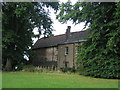
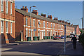
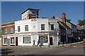

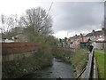
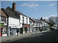

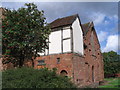
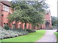
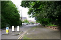
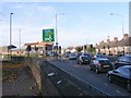
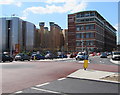
100 photos from this area
Area Information
Key information about the CV1 2BW including its size, population, and administrative classification.
- Area Type
- Postcode
- Area Size
- 7016 m²
- Population
- 2094
- Population Density
- 8130 people/km²
House Prices in CV1 2BW
37
Properties
£109,672
Average Sold Price
£20,000
Lowest Price
£240,000
Highest Price
Showing 37 properties
| Address | Type | Beds | Baths | Last Sale Price | Last Sale Date | |
|---|---|---|---|---|---|---|
| 58 David Road, Coventry, CV1 2BW | Semi-detached | 3 | 1 | £180,000 | Aug 2025 | |
| 24 David Road, Coventry, CV1 2BW | Terraced | 4 | 2 | £145,000 | Dec 2024 | |
| 16 David Road, Coventry, CV1 2BW | house | 4 | 1 | £240,000 | Oct 2022 | |
| 40 David Road, Coventry, CV1 2BW | Terraced | 4 | 3 | £164,000 | Sep 2021 | |
| 4 David Road, Coventry, CV1 2BW | Terraced | 1 | 1 | £155,000 | Jun 2021 | |
| 14 David Road, Coventry, CV1 2BW | Terraced | 4 | 4 | £195,000 | Jul 2019 | |
| 20 David Road, Coventry, CV1 2BW | Terraced | 1 | 1 | £170,000 | Jan 2019 | |
| 46 David Road, Coventry, CV1 2BW | Terraced | 3 | 1 | £90,000 | Oct 2015 | |
| 44 David Road, Coventry, CV1 2BW | Terraced | 2 | - | £102,000 | Aug 2014 | |
| 52 David Road, Coventry, CV1 2BW | Flat | 2 | 2 | £60,000 | Dec 2013 |
Page 1 of 4
Energy Efficiency in CV1 2BW
Amenities
Schools
| Rank | School | Type | Entry gender | Ages |
|---|
Explore more schools in this area
Go to Schools tabDemographics
Household Size
Family (3-5 people)
most common
Accommodation Type
Houses
most common
Tenure
37
majority
Ethnic Group
White
most common
Religion
N/A
most common
Household Composition
N/A
most common
Age
22
median
Young Adults (15-29 years)
most common
Household Deprivation
N/A
with no deprivation
NS-SEC
11
in Lower managerial occupations
Explore more demographic insights in this area
Go to Demographics tabPlanning
Planning Constraints
- Flood RiskPremium
- Ramsar Wetland SitesPremium
- Area of Outstanding Natural BeautyPremium
- Protected Nature ReservePremium
- Protected WoodlandPremium