Area Overview for CV1 1NE
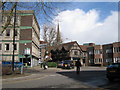
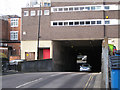
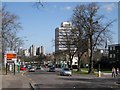
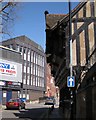
Photos of CV1 1NE


Area Information
Living in CV1 1NE means occupying a specific residential cluster within Coventry, England, defined by tight boundaries and high density. This postcode covers a mere 1393 square metres of land yet supports a population of 2870 people. The resulting population density is exceptionally high, reaching 2059717 people per square kilometre. Such figures place CV1 1NE in a unique tier of urban concentration where space is a premium commodity rather than a standard feature. You will find yourself in a compact environment where every square metre serves thousands of residents. The area functions as a dense pocket within the wider city fabric, offering immediate immersion in urban living. Daily life here is characterised by proximity, with immediate access to the broader amenities of Coventry. The sheer volume of inhabitants within this small footprint creates an intense atmosphere of constant activity. prospective homebuyers should understand that choosing a home in CV1 1NE selects a location defined by maximum occupancy and minimal land area. The area represents a specific slice of the city where density dictates the pace of existence.
- Area Type
- Postcode
- Area Size
- 1393 m²
- Population
- Not available
- Population Density
- Not available
The property market in CV1 1NE is defined by intense rental demand and a scarcity of owner-occupied stock. With home ownership sitting at only 9%, this postcode operates as a classic rental market where leases change frequently amidst a rotating cast of young tenants. Flats represent the predominant accommodation type, aligning with the area's extreme population density of 2059717 people per square kilometre. You are unlikely to find detached houses or large semi-detached properties in this specific residential cluster. Instead, the housing stock consists of high-rises and compact units designed to maximise output within the 1393 square metres of available land. Buyers looking for stability in CV1 1NE must prepare for a competitive bidding war on top-tier rental inventory or convertible leasehold opportunities. The market dynamic reflects the demands of a population whose median age is just 22 years. Investment here offers high liquidity but requires vigilance against fluctuating tenant retention rates. The concentration of flats means that any single development influences the local character significantly. Prospective buyers should view homes in CV1 1NE as urban stepping stones rather than permanent family homesteads. The 1393 square metre limit strictly caps building potential, enforcing a vertical rather than horizontal property model.
House Prices in CV1 1NE
Showing 2 properties
| Address | Type | Beds | Baths | Last Sale Price | Last Sale Date | |
|---|---|---|---|---|---|---|
| Second Floor, 24 Broadgate, Coventry, CV1 1NE | Office | - | - | - | - | |
| Third Floor, 24 Broadgate, Coventry, CV1 1NE | Office | - | - | - | - |
Energy Efficiency in CV1 1NE
Your daily life in CV1 1NE extends well beyond the immediate retail and transport nodes within practical reach. You will find five retail outlets nearby, including notable names such as Tesco Coventry, Spar, and M&S Coventry. These supermarkets form the core of your grocery shopping routine, offering immediate access to fresh food and household essentials without long commutes. Five railway stations lie within easy reach, comprising Canley Railway Station, Coventry Arena Railway Station, and Tile Hill Railway Station. These rail links provide rail-based transport options that connect you to the wider Severn Valley line network. Two airports, both listed as Coventry Airport, are located nearby, offering air travel connectivity for urgent business trips or leisure holidays. This combination of major retail chains and multiple transport hubs means you can run errands, catch trains, or board planes with minimal travel time. The presence of these specific venues like Spar and Canley Railway Station defines the convenience of the location. Living in CV1 1NE grants you access to high-frequency public transport and essential shopping without needing a large private vehicle. The layout ensures that your daily needs are met by the presence of Tesco Coventry and the adjacent rail network.
Amenities
Schools
Coventry University stands as the primary educational institution nearest to CV1 1NE. Categorized under 'other' in the available school data, it serves the immediate residential cluster and surrounding wards. While this institution focuses on higher education rather than primary or secondary schooling, its presence aligns perfectly with the area's youth-heavy demographic profile. The median age of residents is 22 years, making a university focal point absolutely logical for the community needs. Families seeking primary or secondary schools near CV1 1NE would need to look beyond the immediate postcode boundaries, as the provided data lists only one relevant facility. This educational landscape reinforces the transient, student-centred character of the neighbourhood where most children are likely to be graduate students rather than school-age dependents. You will not find a mix of nurseries, primary centres, or comprehensive high schools listed within the direct vicinity of this specific postcode. The academic environment surrounding CV1 1NE is dominated by tertiary learning institutions. This concentration ensures that the area functions effectively as a satellite for higher education, supporting the 2059717 people per square kilometre density with adult learners rather than young children.
| Rank | School | Type | Entry gender | Ages |
|---|
Explore more schools in this area
Go to Schools tabDemographics
The community in CV1 1NE is predominantly defined by young adults, with the most common age range falling between 15 and 29 years. This demographic skew drives the local culture and housing demand towards younger professionals and students. The median age of residents is 22, confirming that this postcode serves as a hub for early-career individuals. Only 9% of households in CV1 1NE claim home ownership, indicating that the vast majority live in rental accommodation or shared tenancies. Flats constitute the primary accommodation type, reflecting the high-density nature of the site. The predominant ethnic group is Asian, which influences the cultural character and diversity of the local streets. These statistics paint a clear picture of a transient, youthful population rather than established families with generational roots. The low ownership rate suggests that residents are often short-term tenants adapting to the rapid pace of urban Coventry. When you consider living in CV1 1NE, you are entering a community where life begins fresh, driven by ambition and limited long-term ties to the physical neighbourhood.
Household Size
Accommodation Type
Tenure
Ethnic Group
Religion
Household Composition
Age
Household Deprivation
NS-SEC
Explore more demographic insights in this area
Go to Demographics tabPlanning
Planning Constraints
- Flood RiskPremium
- Ramsar Wetland SitesPremium
- Area of Outstanding Natural BeautyPremium
- Protected Nature ReservePremium
- Protected WoodlandPremium