Area Overview for Colton (Lichfield)
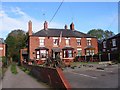
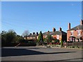
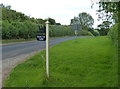
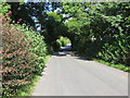
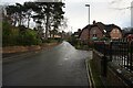
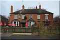
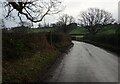
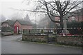
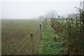
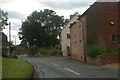
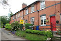
Photos of Colton (Lichfield)
Area Information
Colton (Lichfield) is a compact built-up area spanning 31.3 hectares, nestled within the broader Lichfield region. With a median age of 70, the population reflects a community that leans towards older demographics, suggesting a stable, long-established presence. Home ownership here is high, with 81% of properties owned by residents, indicating a strong sense of permanence. Daily life in Colton is shaped by its proximity to essential services and transport links. The area is served by three rail stations—Rugeley Trent Valley, Rugeley Town, and Hednesford—offering easy access to nearby towns and cities. For families, the presence of St Mary’s CofE (A) Primary School and The St. Mary’s CofE Primary School, both rated outstanding by Ofsted, underscores a commitment to education. While the broadband quality is poor, mobile coverage is strong, supporting modern connectivity needs. Colton (Lichfield) blends practicality with a low crime risk, making it a viable choice for those seeking a quieter, well-connected community with established infrastructure.
- Area Type
- Built Up Area 250
- Area Size
- 31.3 hectares
- Population
- Not available
- Population Density
- Not available
The lifestyle in Colton (Lichfield) is defined by its proximity to essential amenities and transport hubs. Within practical reach are five retail spots, including Tesco Etching, Spar -, and Aldi Power Station Road, ensuring daily shopping needs are met. The area’s three rail stations—Rugeley Trent Valley, Rugeley Town, and Hednesford—connect residents to broader networks, facilitating travel to nearby towns and cities. While parks or leisure facilities are not detailed in the data, the presence of retail and transport options suggests a community focused on convenience. The low crime risk and established infrastructure further contribute to a sense of security and stability, making Colton (Lichfield) a practical choice for those prioritising accessibility over expansive recreational spaces.
Amenities
Schools
Colton (Lichfield) is served by two primary schools: St Mary’s CofE (A) Primary School and The St. Mary’s CofE Primary School, both of which cater to younger families. The latter holds an outstanding Ofsted rating, reflecting high standards in education and support for students. While the data does not list secondary schools, the presence of two primary schools with a strong rating indicates a focus on early education. The duplication of names suggests potential oversight in the data, but the availability of a highly rated primary school is a clear advantage for families. This concentration of educational resources supports a community prioritising academic development, though further research would be needed to confirm the full range of school options available to residents.
| Rank | A + A* % | School | Type | Entry gender | Ages |
|---|---|---|---|---|---|
| 1 | N/A | St Mary's CofE (A) Primary School | primary | N/A | N/A |
| 2 | N/A | The St. Mary's CofE Primary School | primary | N/A | N/A |
Explore more schools in this area
Go to Schools tabDemographics
The demographics of Colton (Lichfield) reveal a population where the median age is 70, with the most common age range encompassing the total population. This suggests a community predominantly composed of older residents, likely with long-standing ties to the area. Home ownership is exceptionally high at 81%, indicating a stable housing market with few rental properties. While specific data on household composition and accommodation types is not provided, the high ownership rate implies a settled population with a preference for long-term residency. The absence of detailed figures on diversity or deprivation means the area’s social fabric remains largely unexplored in public records. However, the low crime risk and presence of essential amenities suggest a quality of life that balances practicality with safety for its residents.
Household Size
Accommodation Type
Tenure
Ethnic Group
Religion
Household Composition
Age
Household Deprivation
NS-SEC
Explore more demographic insights in this area
Go to Demographics tabPlanning
Planning Constraints
- Crime RiskLocked