Area Overview for Collett's Green
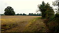
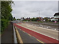
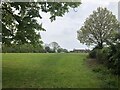
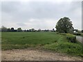
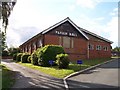
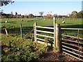
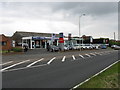
Photos of Collett's Green

Area Information
Collett's Green is a compact built-up area in England, covering 54.8 hectares. Its population is defined by a median age of 70, suggesting a community skewed towards older residents. This area is not a sprawling suburb but a focused neighbourhood with a strong emphasis on home ownership, where 79% of properties are owner-occupied. Daily life here is likely shaped by proximity to essential services and transport links. The presence of five retail outlets, including Co-op Canada and Spar, and five railway stations—such as Worcester Foregate Street and Malvern Link—offers residents practical access to shopping, commuting, and connectivity. While the area’s demographic data lacks detail on household composition or diversity, its high home ownership rate implies a stable, long-term resident base. For those considering living in Collett's Green, the blend of modest area size, mature population, and established infrastructure may appeal to those seeking a quieter, community-focused environment with reliable transport options.
- Area Type
- Built Up Area 250
- Area Size
- 54.8 hectares
- Population
- Not available
- Population Density
- Not available
Living in Collett's Green offers access to a range of practical amenities within walking or short driving distance. The area includes five retail outlets, such as Co-op Canada and Spar, providing essential shopping options for daily needs. Nearby railway stations—Worcester Foregate Street, Malvern Link, and Worcester Shrub Hill—offer convenient commuting routes to larger urban centres. While the data does not specify parks or leisure facilities, the presence of multiple retail and transport hubs suggests a functional, service-oriented lifestyle. The character of the area is likely defined by its older demographic and established infrastructure, making it suitable for those prioritising accessibility over expansive recreational spaces. For residents, the combination of shops, rail links, and a stable community environment creates a practical, low-maintenance living experience.
Amenities
Schools
| Rank | School | Type | Entry gender | Ages |
|---|
Explore more schools in this area
Go to Schools tabDemographics
The population of Collett's Green has a median age of 70, with the most common age range encompassing the total population. This suggests a community where older residents form a significant proportion. Home ownership is high, with 79% of households owning their homes, indicating a stable and long-term resident base. However, the data does not specify household composition, accommodation types, or ethnic diversity, so these aspects remain unquantified. The absence of detailed figures on deprivation or socioeconomic status means that quality of life factors such as access to services or housing affordability cannot be directly assessed from the available data. What is clear is that the area’s demographic profile is defined by its older population and strong home ownership, which may influence local services and community dynamics.
Household Size
Accommodation Type
Tenure
Ethnic Group
Religion
Household Composition
Age
Household Deprivation
NS-SEC
Explore more demographic insights in this area
Go to Demographics tabPlanning
Planning Constraints
- Crime RiskPremium