Area Overview for Charlemont with Grove Vale Ward
Photos of Charlemont with Grove Vale Ward

Area Information
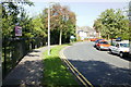
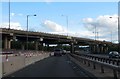
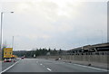
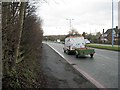
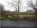
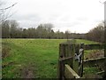
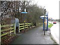
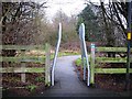
Living in Charlemont with Grove Vale Ward offers a specific residential experience within the Metropolitan Borough of Sandwell. This district borough unitary ward covers a total area of 4.0 km² and currently houses a population of 2,267 residents. The ward encompasses specific neighbourhoods including Charlemont Farm, Bustleholme Mill, Church Vale, Bird End, Wigmore, and Grove Vale, alongside part of the Sandwell Valley. Its geographical coordinates sit approximately at 52.542°N 1.964°W, placing it in the West Midlands region and the West Bromwich East parliamentary constituency. The area holds historical significance, having been known locally as 'Charly Mount' by 1723 and featuring former estates like Charlemont Hall. Housing development expanded significantly from the 1920s, creating the current fabric of private and council estates. You will find residential environments ranging from older areas near the A4031 to large housing developments built in the 1960s. Daily life in Charlemont with Grove Vale Ward is defined by this mix of historical layers and mid-20th-century construction, providing a distinct character within the borough.
- Area Type
- District Borough Unitary Ward
- Area Size
- 4.0 km²
- Population
- 2267
- Population Density
- 571 people/km²
Demographics
The community profile of Charlemont with Grove Vale Ward reveals a mature demographic landscape. The median age for residents stands at exactly 70 years, indicating a population skewed significantly towards older age groups. Home ownership is the dominant tenure type, with 64% of households owning their property outright or with a mortgage. This high level of ownership suggests strong local investment in the area. The ward's total population of 2,267 generates a population density of 571 people per square kilometre, reflecting a moderately urban density for the specific neighbourhoods included. While you will encounter a cross-section of residents across the ward boundaries, the data confirms that the area is primarily populated by retirees or families with older children. Few specific statistics are provided regarding household composition breakdowns, predominant ethnic groups, or religious affiliations for this specific ward, so those aspects remain unquantified in the current records. Nevertheless, the high ownership rate and older median age suggest a community stable in terms of long-term residence rather than transient renting.
Household Size
Accommodation Type
Tenure
Ethnic Group
Religion
Household Composition
Age
Household Deprivation
NS-SEC
Explore more demographic insights in this area
Go to Demographics tabPlanning
Planning Constraints
- Flood RiskPremium
- Ramsar Wetland SitesPremium
- Area of Outstanding Natural BeautyPremium
- Protected Nature ReservePremium
- Protected WoodlandPremium
- Crime RiskPremium