Area Overview for Camp Hill Ward
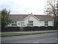
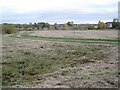
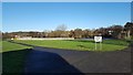
Photos of Camp Hill Ward

Area Information
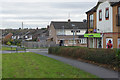
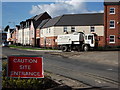
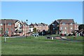
Camp Hill Ward is a 2.1 square kilometre district situated within Nuneaton in the West Midlands. The area lies approximately 2.4 kilometres north-west of Nuneaton town centre. It holds a population of approximately 2,205 residents. The ward originates from a post-war housing estate constructed in the 1950s by the National Coal Board specifically to house local miners. This history shapes the current character of the neighbourhood, which features pockets of deprivation alongside ongoing regeneration efforts that began in 1999. Former Camp Hill Hall, a Tudor-style mansion demolished in the 1930s, once stood on the site where St. Mary's and St. John's Church was later established via a mission starting in 1953. Living in Camp Hill Ward means residing in a community with deep industrial roots, where the physical landscape still reflects its origins as a provision for coalfield workers. The area is not a quiet rural retreat or a modern gated community, but rather a functional suburb with a distinct working-class identity. Prospective buyers will find a compact neighbourhood where the past remains visible in the architecture and community institutions. The location offers proximity to the town centre while maintaining a residential focus. You can expect a lived-in atmosphere where economic improvement projects continue to unfold alongside established homes.
- Area Type
- District Borough Unitary Ward
- Area Size
- 2.1 km²
- Population
- Not available
- Population Density
- Not available
Demographics
The community profile in Camp Hill Ward is defined by a significant proportion of older residents. The median age for the population is 70 years. This high average suggests a demographic skewed towards retirees or long-term settled families. Home ownership levels stand at 58 per cent, indicating that a majority of residents either purchase their own properties or own outright rather than renting from an external landlord. Regarding household composition and accommodation types, the available data indicates totals for these categories are recorded but does not break down specific structures into terraced, semi-detached, or flats. The ward is identified as one of Warwickshire's most deprived wards, a fact that influences daily life and local services. This designation follows the economic decline of the local mining industry in the 1980s. Regeneration efforts initiated in 1999 targeted physical, environmental, and economic improvements to address these challenges. You should understand that living here involves a community with age-specific needs and economic challenges that local authorities actively manage through regeneration. The population size of roughly 2,200 means services are concentrated in a small footprint, which can affect travel times for residents seeking broader amenities outside the ward boundaries.
Household Size
Accommodation Type
Tenure
Ethnic Group
Religion
Household Composition
Age
Household Deprivation
NS-SEC
Explore more demographic insights in this area
Go to Demographics tabPlanning
Planning Constraints
- Flood RiskPremium
- Ramsar Wetland SitesPremium
- Area of Outstanding Natural BeautyPremium
- Protected Nature ReservePremium
- Protected WoodlandPremium
- Crime RiskPremium