Area Overview for Caldecote
Photos of Caldecote
Area Information
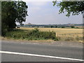
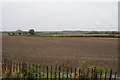
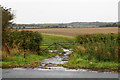
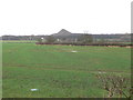
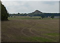
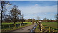
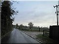
Caldecote is a small civil parish covering just 2.6 square kilometres in England. This compact size defines the local environment, creating a neighbourhood where daily life revolves around immediate surroundings rather than long commutes across vast distances. Residents live in a setting that prioritises proximity over scale, ensuring that essential services and local amenities remain within easy reach. The area functions as a self-contained community where the boundary between home and local life is often indistinct. You can expect a village atmosphere where the limited land area fosters a close-knit relationship between inhabitants and their immediate landscape. Living in Caldecote means embracing a specific type of rural or semi-rural existence characterised by its precise boundaries. The town's physical constraints shape the rhythm of daily activities, from school runs to shopping trips. Because the parish is so small, you may find that the same handful of streets host a significant portion of the local population. This concentration supports a familiar, localised routine rather than the anonymity found in larger urban centres. The area appeals to those seeking a defined environment where the limits of their locality are clear and manageable. Understanding the true extent of Caldecote helps you appreciate the scale of life within these borders. The character of the neighbourhood remains consistent with its modest footprint, avoiding the sprawl associated with larger municipalities. Your experience of Caldecote will be coloured by this intimate sense of place. The area accommodates a steady number of homes without the overwhelming density that characterises larger towns. This balance allows residents to maintain a connection to the built environment while retaining access to the quieter aspects of parish life. The small size serves as a defining feature for anyone considering a move to the location.
- Area Type
- Parish
- Area Size
- 2.6 km²
- Population
- Not available
- Population Density
- Not available
Demographics
The community profile of Caldecote reveals a distinctly mature population with a median age of 70 years. You should expect to encounter an area where residents are significantly older than the national average, reflecting a settlement that largely caters to retirees and long-term settled families. This demographic skew means that the daily activity levels and social rhythms differ from younger, family-heavy districts. The most common age grouping is the total population, underscoring that the entire community clusters around this higher age bracket rather than spanning multiple generations evenly. Home ownership stands at 67 per cent, indicating that a clear majority of residents own their properties outright or with a mortgage. This high rate signals a stable community where people have deep roots in the locality. Such figures suggest that the local estate consists primarily of owner-occupied stock rather than a transient rental market. The accommodation types align with this ownership model, supporting a residential pattern where families have remained in Caldecote for extended periods. You will find few temporary occupants, as the high ownership rate creates a settled atmosphere where neighbours know each other by name. Diversity metrics within the parish follow standard patterns, though the dominant ethnic group remains broad-based across the total population. Religious affiliation similarly reflects the general distribution found in the total demographic count. For someone considering homes in Caldecote, these statistics paint a picture of a quiet, stable environment. The lack of younger families or transient workers contributes to a peaceful atmosphere. Safety and community cohesion thrive in this setting, driven by a population that shares similar life stages and long-term commitments to the area.
Household Size
Accommodation Type
Tenure
Ethnic Group
Religion
Household Composition
Age
Household Deprivation
NS-SEC
Explore more demographic insights in this area
Go to Demographics tabPlanning
Planning Constraints
- Flood RiskPremium
- Ramsar Wetland SitesPremium
- Area of Outstanding Natural BeautyPremium
- Protected Nature ReservePremium
- Protected WoodlandPremium
- Crime RiskPremium