Area Overview for Bilston South Ward
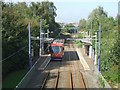
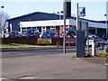
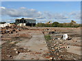
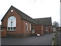
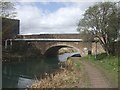
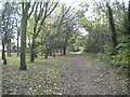
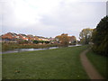
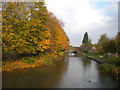
Photos of Bilston South Ward

Area Information
Bilston South Ward is a compact district covering just 4.6 square kilometres within Staffordshire, western England. This small but distinct borough ward offers a defined sense of place for those seeking a settlement of manageable size. You will find a community where the physical footprint limits sprawl, creating a focused environment for daily life. Living in Bilston South Ward means dealing with a clear, bounded area where local geography shapes the resident experience. The ward's classification as a district borough unitary ward indicates its specific administrative role within the wider local government structure. For homebuyers, the compact nature of this area suggests easy accessibility to local amenities without the vast distances found in larger cities. Daily life here revolves around the immediate surroundings because so much of the necessary infrastructure is concentrated within this 4.6 square kilometre boundary. The area presents a straightforward profile, avoiding overly complex or sprawling developments. You can expect a neighbourhood where the scale of the estate matches the scope of typical travel and commuting needs. ### The community in Bilston South Ward is distinctively characterised by an older resident population. The median age stands at 70 years, indicating that the area attracts or retains a demographic significantly older than the national average. This age profile influences how you might use your home, as many residents require facilities suited to an elderly population or have family obligations to older relatives. Only 44% of homes in Bilston South Ward are owned outright or have a mortgage, suggesting that rental accommodation remains a significant part of the local housing stock. The remaining households live in rented properties, which often changes the tenure security for tenants and the investment landscape for buyers. The provided data does not specify the dominant ethnic group or religious composition, so you cannot make assumptions about diversity levels in this ward based on available figures. Households are defined largely by the total composition available in the dataset, without further breakdown into family units or singles. The accommodation types listed as totals mean the specific mix of terraced, semi-detached, or detached homes is not detailed here. Living in Bilston South Ward means engaging with a community where the demographic weight is heavily skewed towards senior citizens, shaping the local services and social fabric accordingly. ### The property market in Bilston South Ward is heavily influenced by a relatively low rate of homeownership. With only 44% of residents owning their homes, the area functions significantly as a rental market where housing stock changes hands frequently through tenancies. This statistic suggests that if you are purchasing property in Bilston South Ward, you are entering a region where a majority of the population rents rather than owns. The low homeownership percentage often correlates with higher densities of social or private rented accommodation, typical of areas with older demographics like this one. The data lists accommodation types only as a total, meaning the specific ratio of terraced homes to detached properties is not explicitly detailed in current figures. You must assume a housing stock that responds to the needs of the 70-year median age, which often means more bungalows or single-level housing. The market dynamics here differ from areas with high ownership rates where homeowners drive up demand and property values through long-term investment. Buying in Bilston South Ward requires understanding that the area serves as a hub for tenants, meaning certain properties may have shorter tenancy histories or higher turnover. The 44% ownership figure is the only concrete metric available to guide your expectation of tenure stability in this ward. ### Digital connectivity in Bilston South Ward is excellent, offering robust support for remote working and home entertainment. The fixed broadband quality score reaches 96 out of 100, which represents top-tier internet performance for the area. This score indicates that households can rely on fast, reliable speeds for video calls, streaming services, and heavy data usage without frequent interruptions. Excellent broadband access means you can choose to work from home effectively, a vital consideration if your job requires regular video conferencing or cloud-based access. A high score of 96 suggests the infrastructure is well-developed, removing connectivity from a potential concern when viewing homes in Bilston South Ward. Mobile connectivity follows a similar pattern of strength, ensuring you have silence and coverage throughout the ward where physical signals are strong. For residents who commute to office-based jobs nearby, this outward connectivity ensures顺畅 communication remains strong even when traveling from the ward's boundaries. The high digital standard makes this a practical choice for modern professionals or retirees who rely on internet services for banking, healthcare appointments, or staying in touch with friends and family. You should expect uninterrupted access to essential online services while living in this specific geographical district. ### Safety in Bilston South Ward presents a mixed picture that requires balanced consideration from any prospective resident. Your assessment starts with a crime risk level marked as a warning, with a score of 39 out of 100 where lower scores indicate less risk. This medium crime risk means that standard security precautions are advisable for any property you purchase or rent. You should install reliable locks, use secure doors, and perhaps invest in alarm systems, as the area does not enjoy a low crime environment like other parts of the country might. Despite this warning, the area shows positive environmental indicators. Flood risk coverage scores 9.32, a low risk level that reassures you about the safety of your home against water damage during heavy weather events. There are no Ramsar wetland sites, Areas of Outstanding Natural Beauty, protected nature reserves, or protected woodland areas within the ward, which simplifies planning constraints for future extensions or garden work. These planning clearance scores of effectively zero mean you face no significant environmental hurdles when building or modifying a property in Bilston South Ward. You must weigh the medium crime risk against the low flood risk when evaluating the overall safety of your potential new home. ### Who typically lives in Bilston South Ward? What appears in Bilston South Ward is a community skewed significantly towards older residents. The median age here is 70 years, meaning a large portion of the population is in their senior years. Only 44% of households own their homes, with the majority renting. The area covers just 4.6 square kilometres, creating a dense environment. Schools near Bilston South Ward are not detailed in the current data, so you will need to research local education separately. The lack of specific demographic breakdowns means you cannot definitively state the diversity levels, but the age profile is the clearest indicator of the current community feel. Is Bilston South Ward good for remote workers? Yes, digital infrastructure in Bilston South Ward is excellent for remote working. The fixed broadband score is 96 out of 100, placing the area in the top tier for internet quality. This high-speed connection ensures you can handle video conferences and large file transfers without issues. Mobile connectivity also remains strong throughout the ward. The reliable internet makes living in Bilston South Ward a practical choice for professionals who need consistent online access. You do not need to compromise on connectivity performance when choosing a home in this specific district. What are the main safety concerns for Bilston South Ward? The primary safety concern in Bilston South Ward relates to crime. The crime risk assessment shows a warning level with a score of 39, indicating a medium risk where rates are around the national average. Residents should use standard security measures to protect their homes. Conversely, flood risk is low with a score of 9.32, and there are no planning constraints like protected wetlands or woodlands. You must accept the medium crime risk factor while appreciating the low environmental hazards when considering homes in Bilston South Ward.
- Area Type
- District Borough Unitary Ward
- Area Size
- 4.6 km²
- Population
- Not available
- Population Density
- Not available
Demographics
The community in Bilston South Ward is distinctively characterised by an older resident population. The median age stands at 70 years, indicating that the area attracts or retains a demographic significantly older than the national average. This age profile influences how you might use your home, as many residents require facilities suited to an elderly population or have family obligations to older relatives. Only 44% of homes in Bilston South Ward are owned outright or have a mortgage, suggesting that rental accommodation remains a significant part of the local housing stock. The remaining households live in rented properties, which often changes the tenure security for tenants and the investment landscape for buyers. The provided data does not specify the dominant ethnic group or religious composition, so you cannot make assumptions about diversity levels in this ward based on available figures. Households are defined largely by the total composition available in the dataset, without further breakdown into family units or singles. The accommodation types listed as totals mean the specific mix of terraced, semi-detached, or detached homes is not detailed here. Living in Bilston South Ward means engaging with a community where the demographic weight is heavily skewed towards senior citizens, shaping the local services and social fabric accordingly. ### The property market in Bilston South Ward is heavily influenced by a relatively low rate of homeownership. With only 44% of residents owning their homes, the area functions significantly as a rental market where housing stock changes hands frequently through tenancies. This statistic suggests that if you are purchasing property in Bilston South Ward, you are entering a region where a majority of the population rents rather than owns. The low homeownership percentage often correlates with higher densities of social or private rented accommodation, typical of areas with older demographics like this one. The data lists accommodation types only as a total, meaning the specific ratio of terraced homes to detached properties is not explicitly detailed in current figures. You must assume a housing stock that responds to the needs of the 70-year median age, which often means more bungalows or single-level housing. The market dynamics here differ from areas with high ownership rates where homeowners drive up demand and property values through long-term investment. Buying in Bilston South Ward requires understanding that the area serves as a hub for tenants, meaning certain properties may have shorter tenancy histories or higher turnover. The 44% ownership figure is the only concrete metric available to guide your expectation of tenure stability in this ward. ### Digital connectivity in Bilston South Ward is excellent, offering robust support for remote working and home entertainment. The fixed broadband quality score reaches 96 out of 100, which represents top-tier internet performance for the area. This score indicates that households can rely on fast, reliable speeds for video calls, streaming services, and heavy data usage without frequent interruptions. Excellent broadband access means you can choose to work from home effectively, a vital consideration if your job requires regular video conferencing or cloud-based access. A high score of 96 suggests the infrastructure is well-developed, removing connectivity from a potential concern when viewing homes in Bilston South Ward. Mobile connectivity follows a similar pattern of strength, ensuring you have silence and coverage throughout the ward where physical signals are strong. For residents who commute to office-based jobs nearby, this outward connectivity ensures顺畅 communication remains strong even when traveling from the ward's boundaries. The high digital standard makes this a practical choice for modern professionals or retirees who rely on internet services for banking, healthcare appointments, or staying in touch with friends and family. You should expect uninterrupted access to essential online services while living in this specific geographical district. ### Safety in Bilston South Ward presents a mixed picture that requires balanced consideration from any prospective resident. Your assessment starts with a crime risk level marked as a warning, with a score of 39 out of 100 where lower scores indicate less risk. This medium crime risk means that standard security precautions are advisable for any property you purchase or rent. You should install reliable locks, use secure doors, and perhaps invest in alarm systems, as the area does not enjoy a low crime environment like other parts of the country might. Despite this warning, the area shows positive environmental indicators. Flood risk coverage scores 9.32, a low risk level that reassures you about the safety of your home against water damage during heavy weather events. There are no Ramsar wetland sites, Areas of Outstanding Natural Beauty, protected nature reserves, or protected woodland areas within the ward, which simplifies planning constraints for future extensions or garden work. These planning clearance scores of effectively zero mean you face no significant environmental hurdles when building or modifying a property in Bilston South Ward. You must weigh the medium crime risk against the low flood risk when evaluating the overall safety of your potential new home. ### Who typically lives in Bilston South Ward? What appears in Bilston South Ward is a community skewed significantly towards older residents. The median age here is 70 years, meaning a large portion of the population is in their senior years. Only 44% of households own their homes, with the majority renting. The area covers just 4.6 square kilometres, creating a dense environment. Schools near Bilston South Ward are not detailed in the current data, so you will need to research local education separately. The lack of specific demographic breakdowns means you cannot definitively state the diversity levels, but the age profile is the clearest indicator of the current community feel. Is Bilston South Ward good for remote workers? Yes, digital infrastructure in Bilston South Ward is excellent for remote working. The fixed broadband score is 96 out of 100, placing the area in the top tier for internet quality. This high-speed connection ensures you can handle video conferences and large file transfers without issues. Mobile connectivity also remains strong throughout the ward. The reliable internet makes living in Bilston South Ward a practical choice for professionals who need consistent online access. You do not need to compromise on connectivity performance when choosing a home in this specific district. What are the main safety concerns for Bilston South Ward? The primary safety concern in Bilston South Ward relates to crime. The crime risk assessment shows a warning level with a score of 39, indicating a medium risk where rates are around the national average. Residents should use standard security measures to protect their homes. Conversely, flood risk is low with a score of 9.32, and there are no planning constraints like protected wetlands or woodlands. You must accept the medium crime risk factor while appreciating the low environmental hazards when considering homes in Bilston South Ward.
Household Size
Accommodation Type
Tenure
Ethnic Group
Religion
Household Composition
Age
Household Deprivation
NS-SEC
Explore more demographic insights in this area
Go to Demographics tabPlanning
Planning Constraints
- Flood RiskPremium
- Ramsar Wetland SitesPremium
- Area of Outstanding Natural BeautyPremium
- Protected Nature ReservePremium
- Protected WoodlandPremium
- Crime RiskPremium