Area Overview for Barston
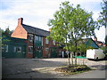
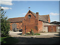
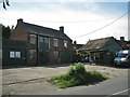
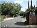
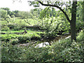
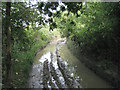
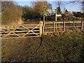
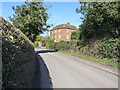
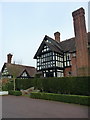
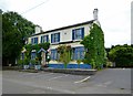
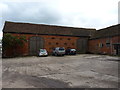
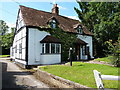
Photos of Barston
Area Information
Barston is a civil parish and village located in the Metropolitan Borough of Solihull, West Midlands. The community sits approximately 4.5 miles east of Solihull and 11 miles southeast of Birmingham, positioned astride Barston Lane. The area occupies 10.5 km² of land defined by the River Blythe and its tributary. A large meander of the river shapes the western edge of the Meriden Gap. The village centre features higher ground surrounded by agricultural pasture land. This geography preserves a largely unspoiled rural appearance for residents. Historical records from the Domesday Book of 1086 refer to the location as Bercestone or Bertonstone. Ownership has shifted from the Knights Templar to the Knights Hospitaller and eventually to Henry VIII. The village became an independent parish in 1894. Today, property numbers include around 50 to 70 dwellings within the village core. Much of the residential area is designated as a Conservation Area. Key landmarks include the Church of St Swithin, built in 1721 on a medieval site. Visitors can also find historic timber-framed buildings along Barston Lane. The balance of history and nature defines daily life for those living in Barston.
- Area Type
- Parish
- Area Size
- 10.5 km²
- Population
- Not available
- Population Density
- Not available
Demographics
The demographic profile of Barston indicates an established, older community. The median age stands at 70 years. This figure suggests a population skewed heavily towards older adults. The most common age range is simply recorded as Age: Total, reflecting the village's singular character. Home ownership rates are high, standing at 77% of households. This level of ownership implies stability and long-term residency within the parish. Accommodation types and religious or ethnic breakdowns are listed as total figures in the available data, which indicates a general, non-segregated household composition. Deprivation is not explicitly detailed with a specific score, but the high percentage of owner-occupied homes often correlates with lower mobility and stronger community ties. The village hosts community activities at the Barston Memorial Institute. These facilities include a youth club, art classes, a Women's Institute, and the U3A. Such amenities support the older demographic while providing engagement for all residents. The population rose to 533 by 2011, following stable numbers around 420 to 499 between 1981 and 2001. Council houses were built after the First World War. This history of housing construction supports current occupancy figures.
Household Size
Accommodation Type
Tenure
Ethnic Group
Religion
Household Composition
Age
Household Deprivation
NS-SEC
Explore more demographic insights in this area
Go to Demographics tabPlanning
Planning Constraints
- Flood RiskPremium
- Ramsar Wetland SitesPremium
- Area of Outstanding Natural BeautyPremium
- Protected Nature ReservePremium
- Protected WoodlandPremium
- Crime RiskPremium