Area Overview for Backbury Ward
Photos of Backbury Ward

Area Information
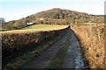
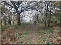
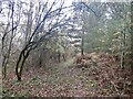
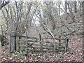
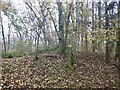
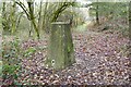
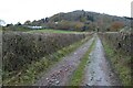
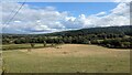
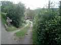
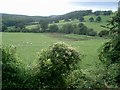
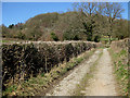
Living in Backbury Ward offers a distinctive experience defined by its rural character and established communities. This district borough unitary ward spans an area of 47.6 km², providing residents with a substantial expanse within the wider Opworks environment. The location does not boast high-density urban sprawl; instead, it presents a landscape where residents enjoy a degree of isolation typical of countryside living. Daily life here differs significantly from urban centres, as the ward prioritises quiet over the buzz of major city streets. You will find that the sense of place is rooted in tradition rather than modern development trends. The ward includes specific designations that shape the visual environment and restrict certain types of building expansion. These constraints include Areas of Outstanding Natural Beauty and protected nature reserves. Such features ensure that your viewlines and surroundings remain largely untouched by large-scale infrastructure projects. When considering homes in Backbury Ward, you are choosing a setting that values conservation and natural beauty. The environment promotes a slower pace of life, which appeals to those seeking alternatives to fast-moving city living. You can expect a community where proximity to green spaces is a fundamental aspect of home ownership. The area's size allows for varied neighbourhoods while maintaining a cohesive local identity that has remained stable over time.
- Area Type
- District Borough Unitary Ward
- Area Size
- 47.6 km²
- Population
- Not available
- Population Density
- Not available
Demographics
The community in Backbury Ward presents a clear and distinct demographic profile centred on older generations. The median age stands at 70 years, confirming that this is predominantly a retirement district. Most residents fall within age ranges associated with later life stages, creating a neighbourhood atmosphere that lacks the young families and students common in other parts of Britain. Home ownership is prevalent among households, with 73% of residents owning their property outright. This high proportion of owner-occupiers contributes to a stable community where long-term residents form the backbone of local institutions. The household composition reflects this age profile, with fewer young child-rearing units compared to mixed-age boroughs. Accommodation types generally align with the needs of this demographic, favouring single-level living or properties adapted for accessibility. Diversity in terms of ethnicity and religion does not feature prominently in the available statistics, suggesting a relatively homogenous population. This demographic reality means that social interactions often centre on neighbours who have lived in Backbury Ward for decades. You will encounter a community where intergenerational balance leans heavily towards the elderly. Understanding this age structure is vital if you are evaluating whether the area suits your lifestyle. The lack of youth demographics also influences local service provision and recreational opportunities available to residents of Backbury Ward.
Household Size
Accommodation Type
Tenure
Ethnic Group
Religion
Household Composition
Age
Household Deprivation
NS-SEC
Explore more demographic insights in this area
Go to Demographics tabPlanning
Planning Constraints
- Flood RiskPremium
- Ramsar Wetland SitesPremium
- Area of Outstanding Natural BeautyPremium
- Protected Nature ReservePremium
- Protected WoodlandPremium
- Crime RiskPremium