Area Overview for B98 8RY
Photos of B98 8RY
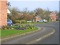
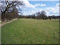
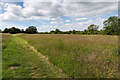


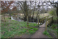
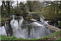
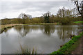
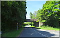

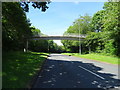
25 photos from this area
Area Information
Key information about the B98 8RY including its size, population, and administrative classification.
- Area Type
- Postcode
- Area Size
- 6241 m²
- Population
- 1059
- Population Density
- 1320 people/km²
House Prices in B98 8RY
12
Properties
£287,361
Average Sold Price
£188,000
Lowest Price
£392,250
Highest Price
Showing 12 properties
| Address | Type | Beds | Baths | Last Sale Price | Last Sale Date | |
|---|---|---|---|---|---|---|
| 14 Rush Lane, Redditch, B98 8RY | Detached | 3 | 2 | £345,000 | Mar 2024 | |
| 20 Rush Lane, Redditch, B98 8RY | Retail | 3 | 2 | £392,250 | Sep 2022 | |
| 6 Rush Lane, Redditch, B98 8RY | Detached | 3 | 2 | £282,000 | Oct 2020 | |
| 16 Rush Lane, Redditch, B98 8RY | Detached | 4 | 1 | £325,000 | Oct 2019 | |
| 4 Rush Lane, Redditch, B98 8RY | Detached | 4 | 1 | £320,000 | May 2017 | |
| 12 Rush Lane, Redditch, B98 8RY | Semi-detached | 3 | - | £242,000 | Oct 2015 | |
| 8 Rush Lane, Redditch, B98 8RY | Bungalow | - | - | £250,000 | Dec 2009 | |
| 2 Rush Lane, Redditch, B98 8RY | Detached | - | - | £242,000 | Jun 2007 | |
| 22 Rush Lane, Redditch, B98 8RY | Detached | - | - | £188,000 | Dec 2002 | |
| 18 Rush Lane, Redditch, B98 8RY | Detached | 3 | 2 | - | - |
Page 1 of 2
Energy Efficiency in B98 8RY
Amenities
Schools
| Rank | School | Type | Entry gender | Ages |
|---|
Explore more schools in this area
Go to Schools tabDemographics
Household Size
Two person
most common
Accommodation Type
Houses
most common
Tenure
96
majority
Ethnic Group
White
most common
Religion
N/A
most common
Household Composition
N/A
most common
Age
47
median
Adults (30-64 years)
most common
Household Deprivation
N/A
with no deprivation
NS-SEC
44
in Lower managerial occupations
Explore more demographic insights in this area
Go to Demographics tabPlanning
Planning Constraints
- Flood RiskPremium
- Ramsar Wetland SitesPremium
- Area of Outstanding Natural BeautyPremium
- Protected Nature ReservePremium
- Protected WoodlandPremium