Area Overview for B98 8NX
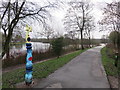
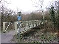
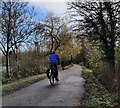
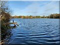
Photos of B98 8NX
Area Information
Living in B98 8NX means residing within Greenlands, a specific residential cluster in Redditch with a population of 2,068 people. This postcode covers an area of just 6,710 square metres, creating a tightly knit environment where neighbours are likely to know one another. The district is defined by its location between Woodrow and Lodge Park, accessed via Greenlands Drive and Studley Road. You will find yourself in a suburb shaped by post-war development, with housing estates primarily built during the 1950s, 1960s and 1970s. This era-specific architecture gives the area a distinct character compared to newer builds or historic city centres. Daily life here centres around local amenities and community railways rather than distant city attractions. The area's compact size means everything is within practical reach, from the South Redditch Sports and Social Club to The Greenlands pub, which has served the community since 1958. Small local shops dot Dowler's Hill Crescent, offering essentials close to your home. Whether you are commuting via nearby railway stations or relying on local storefronts, B98 8NX provides a self-contained suburban experience. It is a place where the history of mid-century construction meets the modern needs of contemporary families and professionals.
- Area Type
- Postcode
- Area Size
- 6710 m²
- Population
- 2068
- Population Density
- 2893 people/km²
The property market in B98 8NX is defined by its status as a small, post-war residential estate. With houses as the primary accommodation type, buyers looking for this postcode will find a selection of detached and semi-detached properties typical of the 1950s to 1970s. You will rarely encounter flats or modern apartments, as the construction era focused on traditional home structures. The 40% home ownership rate suggests that while the area is balanced, there is a significant presence of owner-occupiers who have likely lived here for decades. This stability often translates to well-maintained properties that have seen multiple generations of residency. For buyers considering homes in B98 8NX, the lack of high-rise developments means you are purchasing ground-level living with direct access to local parks or gardens. The intimate size of the 6,710 square metre area means property values may be influenced heavily by individual home condition rather than broad market trends. You might find that some properties require updates given their age, while others have been modernised over recent years. The mix of owners and renters indicates a healthy market demand, with families preferring the space provided by houses over smaller urban dwellings. This makes the area attractive for those prioritizing space and community over convenience to city centres.
House Prices in B98 8NX
Showing 17 properties
| Address | Type | Beds | Baths | Last Sale Price | Last Sale Date | |
|---|---|---|---|---|---|---|
| 7 Arrow Road South, Redditch, B98 8NX | Semi-detached | 3 | 1 | £170,000 | May 2022 | |
| 20 Arrow Road South, Redditch, B98 8NX | house | - | - | £185,000 | Nov 2021 | |
| 22 Arrow Road South, Redditch, B98 8NX | house | - | - | £165,000 | Nov 2021 | |
| 6 Arrow Road South, Redditch, B98 8NX | house | 2 | 1 | £132,000 | Mar 2016 | |
| 4 Arrow Road South, Redditch, B98 8NX | house | - | - | £117,000 | Jan 2008 | |
| 12 Arrow Road South, Redditch, B98 8NX | Terraced | - | - | £135,000 | Dec 2007 | |
| 2 Arrow Road South, Redditch, B98 8NX | Semi-detached | - | - | £52,000 | Nov 1999 | |
| 14 Arrow Road South, Redditch, B98 8NX | Semi-detached | 3 | 1 | - | - | |
| 3 Arrow Road South, Redditch, B98 8NX | Detached | 4 | 2 | - | - | |
| 16 Arrow Road South, Redditch, B98 8NX | Terraced | - | - | - | - |
Energy Efficiency in B98 8NX
Your daily life in B98 8NX revolves around a modest range of local amenities within practical reach. Five retail outlets serve the immediate needs of residents, including Iceland Redditch, Farmfoods Redditch, and Aldi Redditch. These supermarkets provide access to groceries and household essentials without the need for long journeys. If you prefer specific products or dietary requirements, two other stores in the vicinity likely cover niche needs, bringing the total retail capacity to five locations. Transport enthusiasts and commuters can utilise five nearby railway stations. Redditch Railway Station stands as the primary gateway, supported by Alvechurch Railway Station and Wood End Railway Station. These options facilitate seamless travel for work or leisure. Beyond supermarkets and trains, the local character includes the South Redditch Sports and Social Club, which offers community activities and recreation. The Greenlands pub, formerly the Mayfly Public House since 1958, serves as a social hub for locals. Small independent shops, including an off-licence and a Chinese takeaway, cluster near St John the Evangelist Church on Dowler's Hill Crescent. This mix of large retail chains, community clubs, and local eateries creates a functional and convenient lifestyle for those living here.
Amenities
Schools
Families living in B98 8NX have access to two primary educational options on their doorstep. St George's CofE First School is the nearest primary institution, and it also operates a nursery for younger children. The academy version, St George's CofE First School and Nursery, holds a satisfactory Ofsted rating. This rating indicates that the school meets government expectations for education quality and behaviour management. For parents seeking an academy-backed environment with a religious foundation, this option provides a structured approach to learning. The presence of these specific schools means you do not need to commute far for your children's education. Both institutions focus on small-year-group teaching and a close-knit community ethos, which often appeals to residents in the nearby Greenlands district. The combination of a standard primary school and an academy offers flexibility; some families prefer the traditional CofE approach, while others choose the academy model for its governance structure. Having rated schools so near simplifies the school run and reduces travel time for young children. When evaluating living in B98 8NX, you can be confident that your child will attend a nearby institution without needing to rely on long-distance transport to reach a classroom.
| Rank | School | Type | Entry gender | Ages |
|---|
Explore more schools in this area
Go to Schools tabDemographics
The community in B98 8NX reflects a settled population with a median age of 47 years. Most residents fall into the 30 to 64 age range, indicating that families and professionals dominate the neighbourhood rather than students or retirees. This age profile suggests a stable environment where long-term residents are common. Home ownership stands at 40%, meaning roughly two fifths of households own their properties outright or with a mortgage, while the remainder likely rent. This balance often points to a mix of mature families who have stayed through generations and some tenants seeking stability. Ethnically, the area is predominantly White, mirroring the broader demographics of many established suburbs in the West Midlands. You will find a traditional community feel bolstered by this consistency. Houses form the predominant accommodation type, reinforcing the suburban nature of B98 8NX. There are no large apartment blocks; instead, you will find detached and semi-detached homes typical of post-war estate designs. This housing stock suits families seeking gardens and outdoor space. The slightly higher median age compared to national averages suggests a quieter, family-oriented atmosphere rather than a fast-paced urban lifestyle.
Household Size
Accommodation Type
Tenure
Ethnic Group
Religion
Household Composition
Age
Household Deprivation
NS-SEC
Explore more demographic insights in this area
Go to Demographics tabPlanning
Planning Constraints
- Flood RiskPremium
- Ramsar Wetland SitesPremium
- Area of Outstanding Natural BeautyPremium
- Protected Nature ReservePremium
- Protected WoodlandPremium