Area Overview for B98 7XJ
Photos of B98 7XJ
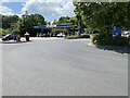
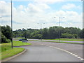
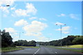
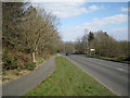

12 photos from this area
Area Information
Key information about the B98 7XJ including its size, population, and administrative classification.
- Area Type
- Postcode
- Area Size
- 2.3 hectares
- Population
- 1363
- Population Density
- 6002 people/km²
House Prices in B98 7XJ
66
Properties
£129,532
Average Sold Price
£33,500
Lowest Price
£251,000
Highest Price
Showing 66 properties
| Address | Type | Beds | Baths | Last Sale Price | Last Sale Date | |
|---|---|---|---|---|---|---|
| 25 High Trees Close, Redditch, B98 7XJ | Terraced | 3 | 1 | £190,000 | Jan 2025 | |
| 43 High Trees Close, Redditch, B98 7XJ | Terraced | 3 | 1 | £205,000 | May 2024 | |
| 21 High Trees Close, Redditch, B98 7XJ | Terraced | 3 | 1 | £208,000 | May 2024 | |
| 5 High Trees Close, Redditch, B98 7XJ | Terraced | 5 | 2 | £251,000 | Sep 2023 | |
| 49 High Trees Close, Redditch, B98 7XJ | Flat | - | - | £130,000 | May 2023 | |
| 11 High Trees Close, Redditch, B98 7XJ | Terraced | 3 | 2 | £197,000 | Jan 2023 | |
| 24 High Trees Close, Redditch, B98 7XJ | house | - | - | £195,000 | Dec 2022 | |
| 26 High Trees Close, Redditch, B98 7XJ | Terraced | 3 | 1 | £176,000 | Jan 2022 | |
| 15 High Trees Close, Redditch, B98 7XJ | Terraced | 3 | 1 | £160,000 | Dec 2020 | |
| 16 High Trees Close, Redditch, B98 7XJ | Terraced | 3 | - | £172,000 | Nov 2020 |
Page 1 of 7
Energy Efficiency in B98 7XJ
Amenities
Schools
| Rank | School | Type | Entry gender | Ages |
|---|
Explore more schools in this area
Go to Schools tabDemographics
Household Size
One person
most common
Accommodation Type
Houses
most common
Tenure
29
majority
Ethnic Group
White
most common
Religion
N/A
most common
Household Composition
N/A
most common
Age
47
median
Adults (30-64 years)
most common
Household Deprivation
N/A
with no deprivation
NS-SEC
20
in Lower managerial occupations
Explore more demographic insights in this area
Go to Demographics tabPlanning
Planning Constraints
- Flood RiskPremium
- Ramsar Wetland SitesPremium
- Area of Outstanding Natural BeautyPremium
- Protected Nature ReservePremium
- Protected WoodlandPremium