Area Overview for B98 7TH
Photos of B98 7TH


Area Information
Wales and England residents might be surprised to learn that B98 7TH represents a specific postcode cluster within Redditch, Worcestershire. This small residential area sits firmly in the New Town sector, forming part of the Matchborough and Woodrow district borough wards established after the Second World War. The local landscape reflects its mid-20th-century origins, with housing developments constructed from the late 1950s and 1960s to accommodate rapid population growth. Today, you will find yourself among 1,604 residents living in a built environment defined by post-war planning rather than pre-war village streets. The density here is high at 1,374 people per square kilometre, indicating a close-knit but compact living arrangement. As you explore the neighbourhood, you are walking through areas that include Woodrow Centre and Matchborough Centre, which serve as the practical heart of daily life. The history of the land is visible in the form of old lanes in sections like Bushley Closes, remnants of Woodrow Farm where construction eventually took place. You are looking at a location that balances the convenience of New Town infrastructure with the heritage of local green spaces and historical sites like Matchborough Pond. For someone considering living in B98 7TH, the area offers a straightforward residential experience characterised by its established community layout and proximity to wider Redditch amenities.
- Area Type
- Postcode
- Area Size
- Not available
- Population
- 1604
- Population Density
- 1374 people/km²
You will find the property market in B98 7TH is overwhelmingly owner-occupied. With 87 per cent of households owning their homes, this is distinctly not a rental-heavy estate. The housing stock consists entirely of houses, meaning you will encounter terraced, semi-detached, or detached family homes rather than flats or purpose-built apartments. This type of tenure structure often correlates with higher price stability and a market driven by established families rather than student tenants or corporate landlords. If you are looking at homes in B98 7TH, you are purchasing into a legacy New Town estate built in the late 1950s and 1960s. These properties have survived for decades, and their condition often reflects the maintenance history of their long-term owners. The area does not offer the variety of tenures found in new-build developments or inner-city regeneration zones. Instead, you are dealing with a traditional, non-gentrified market where residents have made the area their home for a significant period. For buyers, this means entering a market where resale values are likely supported by the continuity of local ownership, although specific price trends are not provided.
House Prices in B98 7TH
No properties found in this postcode.
Energy Efficiency in B98 7TH
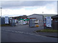
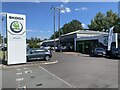
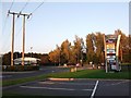
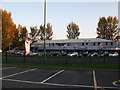
Daily life in B98 7TH centres around the convenience of the two main district shopping outlets available within the area. You have access to Spar and Morrisons Daily Redditch 6-7 for quick groceries, as well as Tesco Lodge for larger shopping trips. These three retailers alone ensure that basic household needs are met locally. Beyond essentials, the area offers four recorded railway stations in close proximity, facilitating easy travel without a car. Matchborough Centre and Woodrow Centre provide the main retail hubs, with the former situated next to the scenic Matchborough Pond. This shopping centre also houses Arrow Vale High School and Matchborough First School, integrating community and learning spaces. Woodrow Centre is anchored by the Woodrow Community Centre and the Woodrow Library, offering cultural resources and meeting spaces for the public. The presence of the Alexandra Hospital in the vicinity means that major healthcare facilities are nearby, reducing travel time for medical appointments. For residents, this layout ensures that great care, education, and shopping are all accessible without needing to leave the immediate impact zone of the New Town.
Amenities
Schools
Families living in B98 7TH have several educational options within their local vicinity. The area is served by Woodrow First School, which holds a good Ofsted rating and provides primary education for young children. Nearby parents have another choice at Redditch, the Leys High School, which operates as a primary institution despite its name suggesting secondary levels. Tudor Grange Academy Redditch also stands close by, designated as an academy with a good Ofsted rating, offering secondary education for older children. St Thomas More Catholic First School is located in the Woodrow district, serving the faith community within the local borders. Additionally, Kingsley College is listed among the primary schools near the postcode. The presence of a pupil referral unit, The Beacon Primary Pupil Referral Unit, indicates that the wider Redditch educational network handles diverse student needs, though specific catchment details for the unit are not listed. The mix of academies and maintained schools suggests a robust local educational framework. You can expect a range of specialisms if you have children attending schools near B98 7TH, with specific mention of primaries and academies delivering good standards where rated.
| Rank | School | Type | Entry gender | Ages |
|---|
Explore more schools in this area
Go to Schools tabDemographics
The community in B98 7TH displays clear statistical markers of a stable, settled population. The median age sits at 47 years, with the most common age range falling between 30 and 64 years. This demographic profile indicates that the area is primarily inhabited by adults in their working or retirement years, rather than young families or very elderly residents living alone. Ownership is a defining feature of the local society, with 87 per cent of households owning their homes. This high rate suggests that most residents have deep roots in the community and are not transient tenants. The accommodation type is exclusively houses, removing the existence of flats or apartments from the immediate living stock. While the predominant ethnic group is White, the high home ownership rate and the concentration of working-age adults likely create a quiet, stable environment. There are no mentions of significant estrangement or extreme wealth gaps in the provided figures, meaning the neighbourhood likely reflects a broad middle-ground of socio-economic status. Deprivation data is not included, so you cannot assess specific income levels relative to national poor averages. However, the fact that the vast majority of people own their property points to a sense of permanence and stability within the B98 7TH housing stock.
Household Size
Accommodation Type
Tenure
Ethnic Group
Religion
Household Composition
Age
Household Deprivation
NS-SEC
Explore more demographic insights in this area
Go to Demographics tabPlanning
Planning Constraints
- Flood RiskPremium
- Ramsar Wetland SitesPremium
- Area of Outstanding Natural BeautyPremium
- Protected Nature ReservePremium
- Protected WoodlandPremium