Area Overview for B98 0LB
Photos of B98 0LB
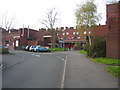
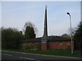
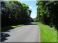
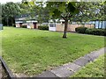
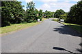
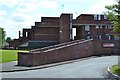
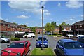
14 photos from this area
Area Information
Key information about the B98 0LB including its size, population, and administrative classification.
- Area Type
- Postcode
- Area Size
- 1.2 hectares
- Population
- 1556
- Population Density
- 6165 people/km²
House Prices in B98 0LB
48
Properties
£135,332
Average Sold Price
£37,500
Lowest Price
£200,000
Highest Price
Showing 48 properties
| Address | Type | Beds | Baths | Last Sale Price | Last Sale Date | |
|---|---|---|---|---|---|---|
| 5 Kinnersley Close, Redditch, B98 0LB | Terraced | 3 | 1 | £190,000 | Dec 2025 | |
| 31 Kinnersley Close, Redditch, B98 0LB | Terraced | 3 | 1 | £170,000 | Sep 2025 | |
| 20 Kinnersley Close, Redditch, B98 0LB | Terraced | 3 | 1 | £195,000 | May 2025 | |
| 34 Kinnersley Close, Redditch, B98 0LB | house | - | - | £195,000 | Mar 2025 | |
| 35 Kinnersley Close, Redditch, B98 0LB | Terraced | 3 | 1 | £200,000 | Apr 2023 | |
| 44 Kinnersley Close, Redditch, B98 0LB | house | - | - | £195,000 | Aug 2022 | |
| 32 Kinnersley Close, Redditch, B98 0LB | Flat | 2 | 1 | £146,000 | Mar 2021 | |
| 14 Kinnersley Close, Redditch, B98 0LB | Terraced | 3 | 1 | £126,000 | Jul 2018 | |
| 43 Kinnersley Close, Redditch, B98 0LB | house | - | - | £157,500 | Dec 2017 | |
| 16 Kinnersley Close, Redditch, B98 0LB | Terraced | 3 | 1 | £170,000 | Aug 2017 |
Page 1 of 5
Energy Efficiency in B98 0LB
Amenities
Schools
| Rank | School | Type | Entry gender | Ages |
|---|
Explore more schools in this area
Go to Schools tabDemographics
Household Size
One person
most common
Accommodation Type
Houses
most common
Tenure
32
majority
Ethnic Group
White
most common
Religion
N/A
most common
Household Composition
N/A
most common
Age
47
median
Adults (30-64 years)
most common
Household Deprivation
N/A
with no deprivation
NS-SEC
13
in Lower managerial occupations
Explore more demographic insights in this area
Go to Demographics tabPlanning
Planning Constraints
- Flood RiskPremium
- Ramsar Wetland SitesPremium
- Area of Outstanding Natural BeautyPremium
- Protected Nature ReservePremium
- Protected WoodlandPremium