Area Overview for B98 0AD
Photos of B98 0AD
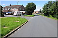
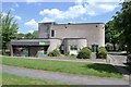
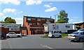
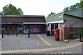
31 photos from this area
Area Information
Key information about the B98 0AD including its size, population, and administrative classification.
- Area Type
- Postcode
- Area Size
- 5.7 hectares
- Population
- 1785
- Population Density
- 3559 people/km²
House Prices in B98 0AD
27
Properties
£214,056
Average Sold Price
£63,000
Lowest Price
£325,000
Highest Price
Showing 27 properties
| Address | Type | Beds | Baths | Last Sale Price | Last Sale Date | |
|---|---|---|---|---|---|---|
| 11 Hatfield Close, Redditch, B98 0AD | Detached | 4 | 1 | £320,000 | Apr 2025 | |
| 24 Hatfield Close, Redditch, B98 0AD | Detached | 3 | - | £325,000 | Sep 2021 | |
| 19 Hatfield Close, Redditch, B98 0AD | house | - | - | £300,000 | Sep 2021 | |
| 7 Hatfield Close, Redditch, B98 0AD | house | - | - | £232,500 | Dec 2019 | |
| 6 Hatfield Close, Redditch, B98 0AD | Detached | 4 | 1 | £285,000 | Oct 2019 | |
| 4 Hatfield Close, Redditch, B98 0AD | Detached | 4 | 3 | £270,000 | Oct 2018 | |
| 21 Hatfield Close, Redditch, B98 0AD | Detached | 3 | - | £207,000 | Apr 2017 | |
| 17 Hatfield Close, Redditch, B98 0AD | Detached | 3 | 1 | £190,000 | Mar 2016 | |
| 18 Hatfield Close, Redditch, B98 0AD | Detached | 3 | 2 | £212,000 | Oct 2014 | |
| 27 Hatfield Close, Redditch, B98 0AD | Detached | 4 | - | £223,000 | Dec 2013 |
Page 1 of 3
Energy Efficiency in B98 0AD
Amenities
Schools
| Rank | School | Type | Entry gender | Ages |
|---|
Explore more schools in this area
Go to Schools tabDemographics
Household Size
Family (3-5 people)
most common
Accommodation Type
Houses
most common
Tenure
58
majority
Ethnic Group
White
most common
Religion
N/A
most common
Household Composition
N/A
most common
Age
47
median
Adults (30-64 years)
most common
Household Deprivation
N/A
with no deprivation
NS-SEC
21
in Lower managerial occupations
Explore more demographic insights in this area
Go to Demographics tabPlanning
Planning Constraints
- Flood RiskPremium
- Ramsar Wetland SitesPremium
- Area of Outstanding Natural BeautyPremium
- Protected Nature ReservePremium
- Protected WoodlandPremium