Area Overview for B97 6QS
Photos of B97 6QS

Area Information
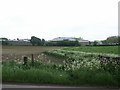
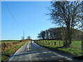
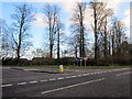
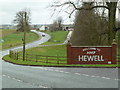
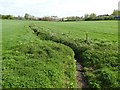
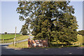
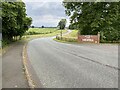
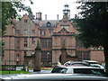
Living in B97 6QS means inhabiting a compact, residential cluster nestled in Worcestershire’s Bromsgrove district. The area spans 18.5 hectares and is home to 1,137 residents, translating to a low population density of 43 people per square kilometre. This small postcode area, part of the civil parish of Tutnall and Cobley, carries historical weight as a former hamlet within Tardebigge parish. Its quiet character is underscored by proximity to landmarks like Hewell Grange, a Grade II* listed former country house now repurposed as an open prison, and Tardebigge Engine House, a derelict relic of the canal era. Daily life here is defined by a stable, mature community, with a median age of 47 and a majority of residents aged 30–64. The area’s compact size and low density suggest a focus on private living, with homes predominantly owner-occupied. For those seeking a blend of historical interest and contemporary convenience, B97 6QS offers a unique slice of rural England, though its small footprint means limited expansion or development.
- Area Type
- Postcode
- Area Size
- 18.5 hectares
- Population
- 1137
- Population Density
- 43 people/km²
The property market in B97 6QS is characterised by a high rate of home ownership (85%) and a focus on detached or semi-detached houses. This suggests a community where private, family homes dominate, with limited rental properties or flats. The small area size—just 18.5 hectares—means the housing stock is constrained, likely resulting in a competitive market for buyers. The prevalence of houses indicates a preference for spacious, traditional living, which may appeal to those seeking a quiet, low-density environment. However, the limited scale of the area means that property options are scarce, and buyers should consider the surrounding regions for broader choices. For those prioritising stability and long-term value, the high home ownership rate signals a reliable, established market. Yet, the compact nature of B97 6QS means that property availability is unlikely to expand significantly.
House Prices in B97 6QS
Showing 3 properties
| Address | Type | Beds | Baths | Last Sale Price | Last Sale Date | |
|---|---|---|---|---|---|---|
| Blocks 1 To 6 Former Hmp Blackenhurst, Hm Prison Hewell Grange, Hewell Lane, Tardebigge, B97 6QS | commercial | - | - | - | - | |
| Dental Practice, Dentist At Hmp Hewell, Hewell Lane, Tardebigge, B97 6QS | commercial | - | - | - | - | |
| Pharmacy, Hmp Hewell, Hewell Lane, Tardebigge, B97 6QS | law_court | - | - | - | - |
Energy Efficiency in B97 6QS
Residents of B97 6QS have access to a modest selection of retail and transport amenities within practical reach. Nearby shops include Tesco Redditch, Spar, and M&S Bordesley BP, offering everyday essentials. The presence of five retail outlets suggests a functional, if unremarkable, shopping experience. Rail connectivity is robust, with five stations—Alvechurch, Redditch, Barnt Green, and others—providing links to regional hubs. While the area lacks detailed information on parks or leisure facilities, its historical sites, such as Hewell Grange, offer cultural interest. The compact nature of the postcode means daily life is centred on nearby services and transport links, with limited scope for expansive recreational activities. For those valuing convenience and proximity to rail, B97 6QS provides a practical base, though its small size may limit options for those seeking diverse leisure opportunities.
Amenities
Schools
| Rank | School | Type | Entry gender | Ages |
|---|
Explore more schools in this area
Go to Schools tabDemographics
The community in B97 6QS is predominantly composed of adults aged 30–64, with a median age of 47. This suggests a mature, settled population, likely with established careers and families. Home ownership is high, at 85%, indicating a stable area where residents are likely to stay long-term. The accommodation type is exclusively houses, reflecting a residential character that prioritises private living over flats or shared spaces. The predominant ethnic group is White, though no specific diversity figures are provided. With 43 people per square kilometre, the area is sparsely populated, offering a quiet, low-density lifestyle. The age profile and home ownership rates suggest a community focused on stability and long-term investment, making it appealing to those seeking a peaceful, family-oriented environment. However, the absence of detailed diversity data means the full demographic picture remains incomplete.
Household Size
Accommodation Type
Tenure
Ethnic Group
Religion
Household Composition
Age
Household Deprivation
NS-SEC
Explore more demographic insights in this area
Go to Demographics tabPlanning
Planning Constraints
- Flood RiskPremium
- Ramsar Wetland SitesPremium
- Area of Outstanding Natural BeautyPremium
- Protected Nature ReservePremium
- Protected WoodlandPremium