Area Overview for B97 6NT
Photos of B97 6NT

Area Information
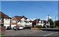
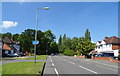
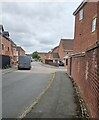
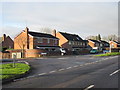
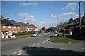
B97 6NT is a small residential cluster in Redditch, a town in north-east Worcestershire, approximately 15 miles south of Birmingham. The area is part of the Batchley & Brockhill district, encompassing parts of Batchley and Brockhill, which reflect Redditch’s post-war expansion and 1964 new town designation. With a population of 1,791, it is a compact community characterised by a mix of housing types, including older post-war properties and newer developments like Brockhill East, which added 960 homes since 1996. Daily life here is shaped by proximity to Redditch town centre, local amenities, and green spaces such as Batchley Pond and Batchley Brook. The area is served by Redditch and Bromsgrove motorways, ensuring easy access to regional hubs. For those seeking a quiet yet connected lifestyle, B97 6NT offers a blend of residential comfort and practical infrastructure. Living here means being near schools, retail outlets, and transport links, while still benefiting from the town’s growth-oriented planning. The area’s history as a housing estate for Birmingham overspill continues to influence its character, with a diverse mix of private, rental, and social housing.
- Area Type
- Postcode
- Area Size
- Not available
- Population
- 1791
- Population Density
- 2786 people/km²
The property market in B97 6NT is shaped by a 45% home ownership rate, which suggests a strong rental market alongside owner-occupied homes. The area is predominantly composed of houses, a characteristic that aligns with its suburban layout and post-war housing developments. This mix includes both older properties from the 1960s and newer estates like Brockhill East, which were constructed in the late 1990s and early 2000s. For buyers, this means a range of housing stock, though the smaller population and compact size of the area may limit availability. The presence of social housing and rental properties also indicates a focus on affordability, making it an option for first-time buyers or those seeking lower-cost housing. However, the market’s character is defined by its balance between older and newer builds, offering both established homes and modern developments.
House Prices in B97 6NT
No properties found in this postcode.
Energy Efficiency in B97 6NT
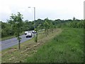
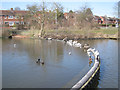
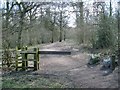
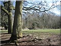
B97 6NT offers a range of amenities within practical reach, including retail outlets such as Tesco Redditch, Spar, and Co-op Redditch. Local shops on Batchley Road provide everyday conveniences, while parks like Batchley Pond offer recreational space for walking, fishing, and relaxation. The area’s natural features, including Batchley Brook and Brockhill Wood, contribute to a green, accessible environment. Sports facilities such as Redditch United F.C.’s Valley Stadium and the Redditch Cricket Club cater to active lifestyles. The proximity to Redditch town centre adds to the convenience, with dining, shopping, and services readily available. This blend of retail, green space, and community facilities fosters a balanced lifestyle, ideal for those seeking both convenience and natural surroundings.
Amenities
Schools
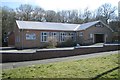
Near B97 6NT, two schools are listed as special schools: Pitcheroak School. While the data does not provide Ofsted ratings, the presence of a special school suggests the area caters to families with children requiring tailored educational support. The local school infrastructure includes Batchley First School and Birchensale Middle School, which serve the broader Batchley and Brockhill districts. For families, this mix of school types offers options for both mainstream and specialist education, though the exact academic performance of these institutions is not detailed in the data. The proximity of schools to residential areas is a key consideration for homebuyers prioritising educational facilities.
| Rank | School | Type | Entry gender | Ages |
|---|
Explore more schools in this area
Go to Schools tabDemographics
The median age in B97 6NT is 47, with the most common age range being adults aged 30–64. This suggests a stable, mature community with a focus on family living and long-term residency. Home ownership stands at 45%, indicating a significant proportion of residents rent their homes, which is typical for areas with substantial social housing. The predominant accommodation type is houses, reflecting a suburban or semi-rural character. The predominant ethnic group is White, though the area’s diversity is not explicitly quantified in the data. The lower home ownership rate may influence the local economy, with rental income and property turnover playing a role in the area’s dynamics. For residents, this profile implies a community with established roots and a balance between private and public housing options.
Household Size
Accommodation Type
Tenure
Ethnic Group
Religion
Household Composition
Age
Household Deprivation
NS-SEC
Explore more demographic insights in this area
Go to Demographics tabPlanning
Planning Constraints
- Flood RiskPremium
- Ramsar Wetland SitesPremium
- Area of Outstanding Natural BeautyPremium
- Protected Nature ReservePremium
- Protected WoodlandPremium