Area Overview for B97 6NS
Photos of B97 6NS
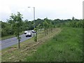

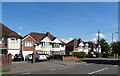
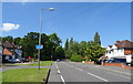
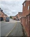
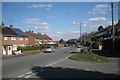
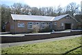

26 photos from this area
Area Information
Key information about the B97 6NS including its size, population, and administrative classification.
- Area Type
- Postcode
- Area Size
- 2.4 hectares
- Population
- 1791
- Population Density
- 2786 people/km²
House Prices in B97 6NS
47
Properties
£182,030
Average Sold Price
£97,950
Lowest Price
£300,000
Highest Price
Showing 47 properties
| Address | Type | Beds | Baths | Last Sale Price | Last Sale Date | |
|---|---|---|---|---|---|---|
| 219 Foxlydiate Crescent, Redditch, B97 6NS | Semi-detached | 3 | 1 | £235,000 | Oct 2024 | |
| 201 Foxlydiate Crescent, Redditch, B97 6NS | Semi-detached | 3 | 1 | £240,000 | Nov 2023 | |
| 175 Foxlydiate Crescent, Redditch, B97 6NS | Semi-detached | 3 | 1 | £211,199 | Apr 2023 | |
| 205 Foxlydiate Crescent, Redditch, B97 6NS | house | - | - | £277,000 | Nov 2022 | |
| 193 Foxlydiate Crescent, Redditch, B97 6NS | Semi-detached | 3 | 2 | £246,000 | Aug 2022 | |
| 173 Foxlydiate Crescent, Redditch, B97 6NS | Semi-detached | 3 | 2 | £153,000 | Aug 2022 | |
| 198 Foxlydiate Crescent, Redditch, B97 6NS | house | 3 | - | £254,500 | Jul 2022 | |
| 204 Foxlydiate Crescent, Redditch, B97 6NS | Retail | 3 | 2 | £300,000 | Jun 2022 | |
| 196 Foxlydiate Crescent, Redditch, B97 6NS | house | - | - | £197,000 | Mar 2022 | |
| 223 Foxlydiate Crescent, Redditch, B97 6NS | house | - | - | £197,000 | May 2021 |
Page 1 of 5
Energy Efficiency in B97 6NS
Amenities
Schools
| Rank | School | Type | Entry gender | Ages |
|---|
Explore more schools in this area
Go to Schools tabDemographics
Household Size
Family (3-5 people)
most common
Accommodation Type
Houses
most common
Tenure
45
majority
Ethnic Group
White
most common
Religion
N/A
most common
Household Composition
N/A
most common
Age
47
median
Adults (30-64 years)
most common
Household Deprivation
N/A
with no deprivation
NS-SEC
18
in Lower managerial occupations
Explore more demographic insights in this area
Go to Demographics tabPlanning
Planning Constraints
- Flood RiskPremium
- Ramsar Wetland SitesPremium
- Area of Outstanding Natural BeautyPremium
- Protected Nature ReservePremium
- Protected WoodlandPremium