Area Overview for B97 6NH
Photos of B97 6NH

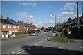
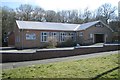
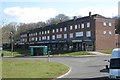
26 photos from this area
Area Information
Key information about the B97 6NH including its size, population, and administrative classification.
- Area Type
- Postcode
- Area Size
- 1.2 hectares
- Population
- 1791
- Population Density
- 2786 people/km²
House Prices in B97 6NH
25
Properties
£128,159
Average Sold Price
£45,250
Lowest Price
£185,000
Highest Price
Showing 25 properties
| Address | Type | Beds | Baths | Last Sale Price | Last Sale Date | |
|---|---|---|---|---|---|---|
| 80 Foxlydiate Crescent, Redditch, B97 6NH | house | 3 | 1 | £163,000 | Mar 2021 | |
| 68 Foxlydiate Crescent, Redditch, B97 6NH | Semi-detached | 3 | 1 | £185,000 | Feb 2020 | |
| 76 Foxlydiate Crescent, Redditch, B97 6NH | Semi-detached | 3 | - | £163,000 | Mar 2017 | |
| 60 Foxlydiate Crescent, Redditch, B97 6NH | house | 3 | - | £125,500 | Jan 2011 | |
| 64 Foxlydiate Crescent, Redditch, B97 6NH | house | - | - | £118,000 | Nov 2008 | |
| 86 Foxlydiate Crescent, Redditch, B97 6NH | house | - | - | £130,000 | May 2008 | |
| 82 Foxlydiate Crescent, Redditch, B97 6NH | house | - | - | £111,000 | Oct 2007 | |
| 33 Foxlydiate Crescent, Redditch, B97 6NH | Semi-detached | - | - | £110,000 | Sep 2005 | |
| 54 Foxlydiate Crescent, Redditch, B97 6NH | house | - | - | £120,000 | Aug 2005 | |
| 84 Foxlydiate Crescent, Redditch, B97 6NH | house | - | - | £139,000 | Jul 2005 |
Page 1 of 3
Energy Efficiency in B97 6NH
Amenities
Schools
| Rank | School | Type | Entry gender | Ages |
|---|
Explore more schools in this area
Go to Schools tabDemographics
Household Size
Family (3-5 people)
most common
Accommodation Type
Houses
most common
Tenure
45
majority
Ethnic Group
White
most common
Religion
N/A
most common
Household Composition
N/A
most common
Age
47
median
Adults (30-64 years)
most common
Household Deprivation
N/A
with no deprivation
NS-SEC
18
in Lower managerial occupations
Explore more demographic insights in this area
Go to Demographics tabPlanning
Planning Constraints
- Flood RiskPremium
- Ramsar Wetland SitesPremium
- Area of Outstanding Natural BeautyPremium
- Protected Nature ReservePremium
- Protected WoodlandPremium