Area Overview for B97 6NE
Photos of B97 6NE

Area Information
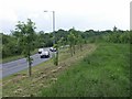
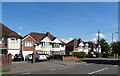
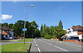
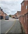
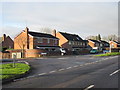
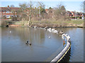
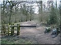
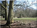
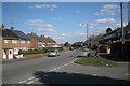
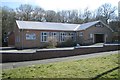
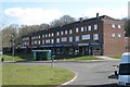
Living in B97 6NE means residing within a very small, high-density cluster covering just 2242 square metres. Despite the modest land area, this postcode supports a population of 1791 people, indicating a tightly knit residential environment. The location sits within the Batchley and Brockhill district in Redditch, approximately 15 miles south of Birmingham. This specific neighbourhood combines elements of the original Batchley housing estate with the more modern developments found in Brockhill. You will find yourself surrounded by a mix of private rental, social housing, and private ownership that reflects the area's evolution from its post-war origins. The character of B97 6NE is defined by its proximity to key local landmarks and its integration into the broader Redditch townscape. Nearby features include Batchley Brook, Cladshill, and Brockhill Wood, which offer natural spaces close to where you would park your car. The area is connected to Redditch United F.C.'s Valley Stadium and local sports clubs, providing easy access to leisure activities without needing to travel far. Daily life here involves navigating a compact zone where housing estates meet local infrastructure. You benefit from being part of a community that has grown significantly since 1996, with ongoing developments like Brockhill East adding to the residential fabric. This specific postcode offers a grounded experience of living in a developing area of Worcestershire, balancing urban convenience with pockets of green space.
- Area Type
- Postcode
- Area Size
- 2242 m²
- Population
- 1791
- Population Density
- 2786 people/km²
House Prices in B97 6NE
Showing 12 properties
| Address | Type | Beds | Baths | Last Sale Price | Last Sale Date | |
|---|---|---|---|---|---|---|
| 6, Pinvin House, Lock Close, Redditch, B97 6NE | Flat | - | - | - | - | |
| 7, Pinvin House, Lock Close, Redditch, B97 6NE | Flat | - | - | - | - | |
| 4, Pinvin House, Lock Close, Redditch, B97 6NE | Flat | - | - | - | - | |
| 1, Pinvin House, Lock Close, Redditch, B97 6NE | Flat | - | - | - | - | |
| 9, Pinvin House, Lock Close, Redditch, B97 6NE | Flat | - | - | - | - | |
| 11, Pinvin House, Lock Close, Redditch, B97 6NE | Flat | - | - | - | - | |
| 8, Pinvin House, Lock Close, Redditch, B97 6NE | Flat | - | - | - | - | |
| 5, Pinvin House, Lock Close, Redditch, B97 6NE | Flat | - | - | - | - | |
| 10, Pinvin House, Lock Close, Redditch, B97 6NE | Flat | - | - | - | - | |
| 2, Pinvin House, Lock Close, Redditch, B97 6NE | Flat | - | - | - | - |
Energy Efficiency in B97 6NE
Amenities
Schools
| Rank | School | Type | Entry gender | Ages |
|---|
Explore more schools in this area
Go to Schools tabDemographics
The community in B97 6NE has a distinct age profile, with a median age of 47 years. Most common residents fall into the working-age bracket between 30 and 64 years. This demographic skew suggests a neighbourhood heavily populated by adults who have likely settled down from their early moving years or are returning to the area after working in nearby cities like Birmingham. Home ownership rates stand at 45%, meaning slightly less than half of the households own their homes outright or via a mortgage. The remaining proportion likely consists of private or social renters, mirroring the area's history of accommodating diverse socio-economic groups. Accommodation types predominantly consist of houses, which aligns with the post-war estate style found in parts of Bat
Household Size
Accommodation Type
Tenure
Ethnic Group
Religion
Household Composition
Age
Household Deprivation
NS-SEC
Explore more demographic insights in this area
Go to Demographics tabPlanning
Planning Constraints
- Flood RiskPremium
- Ramsar Wetland SitesPremium
- Area of Outstanding Natural BeautyPremium
- Protected Nature ReservePremium
- Protected WoodlandPremium