Area Overview for B97 6JR
Photos of B97 6JR


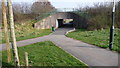
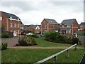
14 photos from this area
Area Information
Key information about the B97 6JR including its size, population, and administrative classification.
- Area Type
- Postcode
- Area Size
- 1.4 hectares
- Population
- 1527
- Population Density
- 3886 people/km²
House Prices in B97 6JR
32
Properties
£147,569
Average Sold Price
£45,500
Lowest Price
£245,000
Highest Price
Showing 32 properties
| Address | Type | Beds | Baths | Last Sale Price | Last Sale Date | |
|---|---|---|---|---|---|---|
| 84 Ash Tree Road, Redditch, B97 6JR | Semi-detached | 4 | 1 | £226,000 | Dec 2024 | |
| 82 Ash Tree Road, Redditch, B97 6JR | Semi-detached | 3 | 1 | £245,000 | Feb 2024 | |
| 45 Ash Tree Road, Redditch, B97 6JR | house | - | - | £187,500 | Apr 2017 | |
| 57 Ash Tree Road, Redditch, B97 6JR | Semi-detached | 3 | - | £136,550 | Jan 2016 | |
| 47 Ash Tree Road, Redditch, B97 6JR | Detached | 3 | 1 | £127,000 | Sep 2013 | |
| 74 Ash Tree Road, Redditch, B97 6JR | Semi-detached | 3 | - | £118,000 | Aug 2012 | |
| 62 Ash Tree Road, Redditch, B97 6JR | house | - | - | £95,000 | Mar 2011 | |
| 65 Ash Tree Road, Redditch, B97 6JR | house | - | - | £45,500 | Nov 1999 | |
| 56 Ash Tree Road, Redditch, B97 6JR | Semi-detached | 3 | 1 | - | - | |
| 78 Ash Tree Road, Redditch, B97 6JR | Semi-detached | 3 | 1 | - | - |
Page 1 of 4
Energy Efficiency in B97 6JR
Amenities
Schools
| Rank | School | Type | Entry gender | Ages |
|---|
Explore more schools in this area
Go to Schools tabDemographics
Household Size
One person
most common
Accommodation Type
Houses
most common
Tenure
32
majority
Ethnic Group
White
most common
Religion
N/A
most common
Household Composition
N/A
most common
Age
47
median
Adults (30-64 years)
most common
Household Deprivation
N/A
with no deprivation
NS-SEC
18
in Lower managerial occupations
Explore more demographic insights in this area
Go to Demographics tabPlanning
Planning Constraints
- Flood RiskPremium
- Ramsar Wetland SitesPremium
- Area of Outstanding Natural BeautyPremium
- Protected Nature ReservePremium
- Protected WoodlandPremium