Area Overview for B97 6JF
Photos of B97 6JF
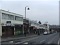
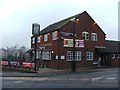
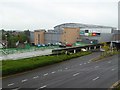
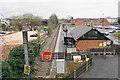
64 photos from this area
Area Information
Key information about the B97 6JF including its size, population, and administrative classification.
- Area Type
- Postcode
- Area Size
- 2962 m²
- Population
- 1897
- Population Density
- 5597 people/km²
House Prices in B97 6JF
12
Properties
£105,096
Average Sold Price
£49,950
Lowest Price
£190,000
Highest Price
Showing 12 properties
| Address | Type | Beds | Baths | Last Sale Price | Last Sale Date | |
|---|---|---|---|---|---|---|
| 24 Fir Tree Close, Redditch, B97 6JF | Terraced | 2 | 1 | £190,000 | Feb 2022 | |
| 42 Fir Tree Close, Redditch, B97 6JF | Terraced | 2 | - | £169,000 | Jun 2020 | |
| 21 Fir Tree Close, Redditch, B97 6JF | Terraced | 2 | - | £147,000 | Dec 2017 | |
| 25 Fir Tree Close, Redditch, B97 6JF | house | - | - | £127,000 | Nov 2016 | |
| 40 Fir Tree Close, Redditch, B97 6JF | Terraced | 2 | 1 | £130,000 | Jul 2016 | |
| 41 Fir Tree Close, Redditch, B97 6JF | Terraced | 2 | 1 | £119,000 | Oct 2013 | |
| 44 Fir Tree Close, Redditch, B97 6JF | Terraced | 2 | 1 | £89,000 | Mar 2003 | |
| 43 Fir Tree Close, Redditch, B97 6JF | house | - | - | £78,500 | Jul 2002 | |
| 23 Fir Tree Close, Redditch, B97 6JF | house | - | - | £54,750 | Jul 1999 | |
| 20 Fir Tree Close, Redditch, B97 6JF | Terraced | 2 | 1 | £55,000 | Dec 1998 |
Page 1 of 2
Energy Efficiency in B97 6JF
Amenities
Schools
| Rank | School | Type | Entry gender | Ages |
|---|
Explore more schools in this area
Go to Schools tabDemographics
Household Size
One person
most common
Accommodation Type
Houses
most common
Tenure
41
majority
Ethnic Group
White
most common
Religion
N/A
most common
Household Composition
N/A
most common
Age
47
median
Adults (30-64 years)
most common
Household Deprivation
N/A
with no deprivation
NS-SEC
19
in Lower managerial occupations
Explore more demographic insights in this area
Go to Demographics tabPlanning
Planning Constraints
- Flood RiskPremium
- Ramsar Wetland SitesPremium
- Area of Outstanding Natural BeautyPremium
- Protected Nature ReservePremium
- Protected WoodlandPremium