Area Overview for B97 6EB
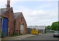
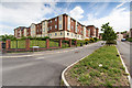
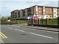
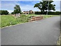
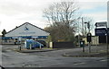
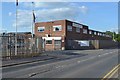
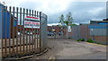
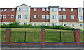
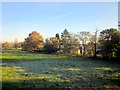
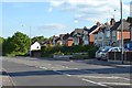
Photos of B97 6EB

Area Information
B97 6EB is a small, tightly packed residential postcode area in England, home to 2,806 people. With a population density of 1,379 people per square kilometre, it reflects a compact, community-focused environment. The area is part of a broader network of settlements in the West Midlands, where historical and industrial legacies shape the local character. Daily life here is likely defined by proximity to services and transport links, given the nearby railway stations and retail hubs. The median age of 47 suggests a mature demographic, with a strong presence of adults aged 30–64. This age range implies a mix of established families and professionals, contributing to a stable, perhaps quieter residential atmosphere. While the area’s small size limits its footprint, its integration with Redditch and surrounding towns offers access to broader amenities. For homebuyers, B97 6EB presents a chance to live in a closely knit community with practical connectivity, though its limited scale means buyers may need to consider nearby areas for more options.
- Area Type
- Postcode
- Area Size
- Not available
- Population
- 2806
- Population Density
- 1379 people/km²
B97 6EB is primarily an owner-occupied area, with 74% of homes owned by residents rather than rented. The accommodation type is predominantly houses, which is unusual for a small postcode area but may reflect a mix of older, larger properties and newer builds. This suggests a housing stock that caters to families or individuals seeking more space, rather than a rental market focused on apartments. The high home ownership rate indicates a stable community with long-term residents, though the small size of the area may limit property diversity. Buyers should consider nearby postcode areas for more options, as B97 6EB’s compact nature may restrict availability. The presence of houses also implies potential for larger properties, which could appeal to those prioritising space over proximity to city centres.
House Prices in B97 6EB
No properties found in this postcode.
Energy Efficiency in B97 6EB
Residents of B97 6EB have access to essential amenities within practical reach. Retail options include Sainsburys Redditch, Farmfoods Redditch, and M&S Bordesley BP, offering grocery and general shopping needs. The nearby railway stations provide transport links to broader destinations, while the compact nature of the area suggests a focus on local services. Though specific parks or leisure facilities are not listed, the proximity to Redditch and surrounding towns likely offers recreational options. The presence of schools, shops, and transport hubs indicates a functional, community-oriented lifestyle, where daily needs can be met without long commutes.
Amenities
Schools
The schools near B97 6EB include St Stephen’s CofE First School, a primary school rated ‘good’ by Ofsted, and Redditch, St Stephen’s CofE Middle School, also a primary. Additional institutions include Holyoakes Field Pupil Referral Unit and The Forge Secondary Short Stay School, which cater to specific educational needs. The mix of mainstream and specialist schools suggests a range of options for families, from general education to support for students with additional requirements. The presence of an academy with a ‘good’ rating indicates at least one high-quality primary option, though secondary schooling may require travel to nearby towns. Parents should verify distances and transport links, as the area’s small size may mean schools are not all within walking distance.
| Rank | School | Type | Entry gender | Ages |
|---|
Explore more schools in this area
Go to Schools tabDemographics
The population of B97 6EB is predominantly adults aged 30–64, with a median age of 47. This suggests a community of established residents, many of whom may be homeowners, as 74% of properties are owner-occupied. The area is characterised by houses rather than flats, reflecting a preference for single-family dwellings. The predominant ethnic group is White, though specific data on diversity is not provided. The high home ownership rate and age profile indicate a stable, long-term resident base. With a population density of 1,379 per square kilometre, the area is densely populated for its size, which may influence the availability of housing. The demographic profile aligns with a mature, family-oriented environment, though the absence of detailed data on deprivation or income levels means the full picture of quality of life remains partially obscured.
Household Size
Accommodation Type
Tenure
Ethnic Group
Religion
Household Composition
Age
Household Deprivation
NS-SEC
Explore more demographic insights in this area
Go to Demographics tabPlanning
Planning Constraints
- Flood RiskPremium
- Ramsar Wetland SitesPremium
- Area of Outstanding Natural BeautyPremium
- Protected Nature ReservePremium
- Protected WoodlandPremium