Area Overview for B97 5UW
Photos of B97 5UW
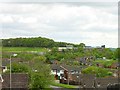
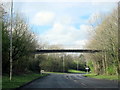
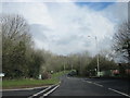
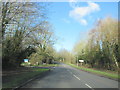
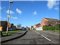


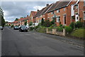
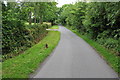
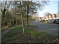
17 photos from this area
Area Information
Key information about the B97 5UW including its size, population, and administrative classification.
- Area Type
- Postcode
- Area Size
- 3.7 hectares
- Population
- 1307
- Population Density
- 63 people/km²
House Prices in B97 5UW
33
Properties
£306,145
Average Sold Price
£91,000
Lowest Price
£515,000
Highest Price
Showing 33 properties
| Address | Type | Beds | Baths | Last Sale Price | Last Sale Date | |
|---|---|---|---|---|---|---|
| 38 Hunt End Lane, Redditch, B97 5UW | Detached | 4 | 2 | £395,000 | Dec 2023 | |
| 21 Hunt End Lane, Redditch, B97 5UW | Detached | 4 | 2 | £500,000 | Nov 2023 | |
| 35 Hunt End Lane, Redditch, B97 5UW | house | 4 | 3 | £515,000 | Aug 2023 | |
| 34 Hunt End Lane, Redditch, B97 5UW | Retail | 4 | 2 | £427,000 | Jul 2022 | |
| 41 Hunt End Lane, Redditch, B97 5UW | Detached | 4 | - | £405,000 | Dec 2021 | |
| 43 Hunt End Lane, Redditch, B97 5UW | house | - | - | £330,000 | Mar 2021 | |
| 32 Hunt End Lane, Redditch, B97 5UW | Detached | 5 | 3 | £328,000 | Aug 2018 | |
| 24 Hunt End Lane, Redditch, B97 5UW | Detached | 4 | 2 | £307,500 | May 2017 | |
| 36 Hunt End Lane, Redditch, B97 5UW | Detached | 6 | 2 | £343,000 | Mar 2017 | |
| 18 Hunt End Lane, Redditch, B97 5UW | house | - | - | £337,500 | Jun 2016 |
Page 1 of 4
Energy Efficiency in B97 5UW
Amenities
Schools
| Rank | School | Type | Entry gender | Ages |
|---|
Explore more schools in this area
Go to Schools tabDemographics
Household Size
Two person
most common
Accommodation Type
Houses
most common
Tenure
85
majority
Ethnic Group
White
most common
Religion
N/A
most common
Household Composition
N/A
most common
Age
47
median
Adults (30-64 years)
most common
Household Deprivation
N/A
with no deprivation
NS-SEC
45
in Lower managerial occupations
Explore more demographic insights in this area
Go to Demographics tabPlanning
Planning Constraints
- Flood RiskPremium
- Ramsar Wetland SitesPremium
- Area of Outstanding Natural BeautyPremium
- Protected Nature ReservePremium
- Protected WoodlandPremium