Area Overview for B97 5TA
Photos of B97 5TA
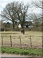
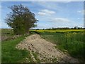
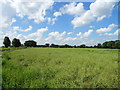
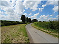
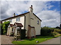
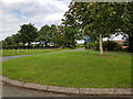
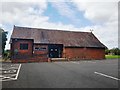
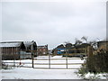
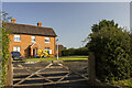
11 photos from this area
Area Information
Key information about the B97 5TA including its size, population, and administrative classification.
- Area Type
- Postcode
- Area Size
- 30.2 hectares
- Population
- 1137
- Population Density
- 43 people/km²
House Prices in B97 5TA
10
Properties
£628,755
Average Sold Price
£534,510
Lowest Price
£723,000
Highest Price
Showing 10 properties
| Address | Type | Beds | Baths | Last Sale Price | Last Sale Date | |
|---|---|---|---|---|---|---|
| The Thatch Cottage, Angel Street, Upper Bentley, B97 5TA | house | - | - | £723,000 | Feb 2019 | |
| Lych Gates, Angel Street, Upper Bentley, B97 5TA | Cottage | 4 | 2 | £534,510 | Sep 2015 | |
| Greenacres, Angel Street, Upper Bentley, B97 5TA | Detached | 4 | 3 | - | - | |
| Seven Acres, Angel Street, Upper Bentley, B97 5TA | Detached | - | - | - | - | |
| Callow Farm, Angel Street, Upper Bentley, B97 5TA | Flat | - | - | - | - | |
| Cefn House, Angel Street, Upper Bentley, B97 5TA | Detached | - | - | - | - | |
| Sling Cottage, Angel Street, Upper Bentley, B97 5TA | Detached | - | - | - | - | |
| Pear Tree Cottage, Angel Street, Upper Bentley, B97 5TA | Terraced | - | - | - | - | |
| Holly Cottage, Angel Street, Upper Bentley, B97 5TA | Detached | - | - | - | - | |
| Three Ways, Angel Street, Upper Bentley, B97 5TA | Detached | - | - | - | - |
Energy Efficiency in B97 5TA
Amenities
Schools
| Rank | School | Type | Entry gender | Ages |
|---|
Explore more schools in this area
Go to Schools tabDemographics
Household Size
Two person
most common
Accommodation Type
Houses
most common
Tenure
85
majority
Ethnic Group
White
most common
Religion
N/A
most common
Household Composition
N/A
most common
Age
47
median
Adults (30-64 years)
most common
Household Deprivation
N/A
with no deprivation
NS-SEC
46
in Lower managerial occupations
Explore more demographic insights in this area
Go to Demographics tabPlanning
Planning Constraints
- Flood RiskPremium
- Ramsar Wetland SitesPremium
- Area of Outstanding Natural BeautyPremium
- Protected Nature ReservePremium
- Protected WoodlandPremium