Area Overview for B97 5SA
Photos of B97 5SA
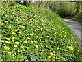
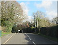
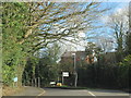
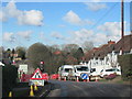
31 photos from this area
Area Information
Key information about the B97 5SA including its size, population, and administrative classification.
- Area Type
- Postcode
- Area Size
- 2.1 hectares
- Population
- 1444
- Population Density
- 3480 people/km²
House Prices in B97 5SA
31
Properties
£283,194
Average Sold Price
£65,000
Lowest Price
£415,000
Highest Price
Showing 31 properties
| Address | Type | Beds | Baths | Last Sale Price | Last Sale Date | |
|---|---|---|---|---|---|---|
| 11 Brotherton Avenue, Redditch, B97 5SA | Detached | 4 | 1 | £370,000 | Jun 2020 | |
| 20 Brotherton Avenue, Redditch, B97 5SA | Detached | 5 | 2 | £400,000 | Jul 2019 | |
| 16 Brotherton Avenue, Redditch, B97 5SA | Detached | 4 | 2 | £390,000 | Jun 2019 | |
| 26 Brotherton Avenue, Redditch, B97 5SA | Bungalow | 2 | 1 | £270,000 | Feb 2019 | |
| 4 Brotherton Avenue, Redditch, B97 5SA | Bungalow | 3 | 1 | £320,000 | Nov 2016 | |
| 30 Brotherton Avenue, Redditch, B97 5SA | Bungalow | 3 | - | £295,000 | Nov 2015 | |
| 33 Brotherton Avenue, Redditch, B97 5SA | Detached | 4 | - | £415,000 | Oct 2014 | |
| 29 Brotherton Avenue, Redditch, B97 5SA | Detached | 4 | 2 | £365,000 | Jul 2014 | |
| 12 Brotherton Avenue, Redditch, B97 5SA | Detached | 5 | 2 | £343,500 | Jul 2014 | |
| 18 Brotherton Avenue, Redditch, B97 5SA | Bungalow | - | - | £263,000 | Dec 2012 |
Page 1 of 4
Energy Efficiency in B97 5SA
Amenities
Schools
| Rank | School | Type | Entry gender | Ages |
|---|
Explore more schools in this area
Go to Schools tabDemographics
Household Size
Family (3-5 people)
most common
Accommodation Type
Houses
most common
Tenure
90
majority
Ethnic Group
White
most common
Religion
N/A
most common
Household Composition
N/A
most common
Age
47
median
Adults (30-64 years)
most common
Household Deprivation
N/A
with no deprivation
NS-SEC
43
in Lower managerial occupations
Explore more demographic insights in this area
Go to Demographics tabPlanning
Planning Constraints
- Flood RiskPremium
- Ramsar Wetland SitesPremium
- Area of Outstanding Natural BeautyPremium
- Protected Nature ReservePremium
- Protected WoodlandPremium