Area Overview for B97 4SH
Photos of B97 4SH
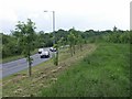

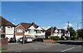
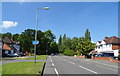
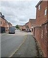
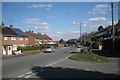
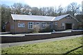
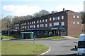
26 photos from this area
Area Information
Key information about the B97 4SH including its size, population, and administrative classification.
- Area Type
- Postcode
- Area Size
- 23.4 hectares
- Population
- 1360
- Population Density
- 1428 people/km²
House Prices in B97 4SH
36
Properties
£190,564
Average Sold Price
£64,000
Lowest Price
£510,000
Highest Price
Showing 36 properties
| Address | Type | Beds | Baths | Last Sale Price | Last Sale Date | |
|---|---|---|---|---|---|---|
| 235 Bromsgrove Road, Redditch, B97 4SH | Detached | 4 | 3 | £510,000 | Apr 2023 | |
| 265 Bromsgrove Road, Redditch, B97 4SH | house | 3 | - | £256,500 | Aug 2021 | |
| 269 Bromsgrove Road, Redditch, B97 4SH | Semi-detached | 3 | 1 | £243,000 | Feb 2020 | |
| 245 Bromsgrove Road, Redditch, B97 4SH | house | - | - | £230,000 | Sep 2018 | |
| 227 Bromsgrove Road, Redditch, B97 4SH | Semi-detached | 3 | 3 | £288,000 | Aug 2018 | |
| 283 Bromsgrove Road, Redditch, B97 4SH | Semi-detached | 3 | - | £244,000 | Aug 2017 | |
| 257 Bromsgrove Road, Redditch, B97 4SH | Detached | 3 | 1 | £164,950 | Dec 2014 | |
| 229 Bromsgrove Road, Redditch, B97 4SH | Semi-detached | 3 | 1 | £213,000 | Nov 2014 | |
| 271 Bromsgrove Road, Redditch, B97 4SH | Semi-detached | 3 | 1 | £162,000 | Nov 2013 | |
| 253 Bromsgrove Road, Redditch, B97 4SH | house | - | - | £155,000 | Jul 2011 |
Page 1 of 4
Energy Efficiency in B97 4SH
Amenities
Schools
| Rank | School | Type | Entry gender | Ages |
|---|
Explore more schools in this area
Go to Schools tabDemographics
Household Size
Family (3-5 people)
most common
Accommodation Type
Houses
most common
Tenure
68
majority
Ethnic Group
White
most common
Religion
N/A
most common
Household Composition
N/A
most common
Age
47
median
Adults (30-64 years)
most common
Household Deprivation
N/A
with no deprivation
NS-SEC
31
in Lower managerial occupations
Explore more demographic insights in this area
Go to Demographics tabPlanning
Planning Constraints
- Flood RiskPremium
- Ramsar Wetland SitesPremium
- Area of Outstanding Natural BeautyPremium
- Protected Nature ReservePremium
- Protected WoodlandPremium