Area Overview for B97 4RU
Photos of B97 4RU
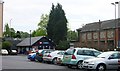
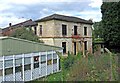
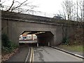
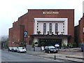
64 photos from this area
Area Information
Key information about the B97 4RU including its size, population, and administrative classification.
- Area Type
- Postcode
- Area Size
- 9488 m²
- Population
- 1360
- Population Density
- 1428 people/km²
House Prices in B97 4RU
23
Properties
£215,300
Average Sold Price
£57,000
Lowest Price
£490,000
Highest Price
Showing 23 properties
| Address | Type | Beds | Baths | Last Sale Price | Last Sale Date | |
|---|---|---|---|---|---|---|
| 21 Ferney Hill Avenue, Redditch, B97 4RU | Terraced | 3 | 2 | £260,000 | Mar 2025 | |
| 27 Ferney Hill Avenue, Redditch, B97 4RU | Semi-detached | 3 | 1 | £248,000 | Jul 2024 | |
| 15 Ferney Hill Avenue, Redditch, B97 4RU | Terraced | 3 | 1 | £238,000 | Feb 2024 | |
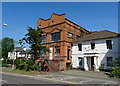
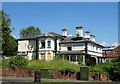
| Ferney Hill House, Ferney Hill Avenue, Redditch, B97 4RU | house | - | - | £490,000 | Mar 2021 | |
| 29 Ferney Hill Avenue, Redditch, B97 4RU | Semi-detached | 4 | 1 | £220,000 | Jan 2021 | |
| 19 Ferney Hill Avenue, Redditch, B97 4RU | house | 3 | 1 | £210,000 | May 2017 | |
| 12 Ferney Hill Avenue, Redditch, B97 4RU | house | - | - | £170,000 | Jul 2016 | |
| 25 Ferney Hill Avenue, Redditch, B97 4RU | house | - | - | £120,000 | Dec 2010 | |
| 14 Ferney Hill Avenue, Redditch, B97 4RU | Semi-detached | 3 | 1 | £140,000 | Mar 2004 | |
| 16 Ferney Hill Avenue, Redditch, B97 4RU | Semi-detached | - | - | £57,000 | Nov 1995 |
Page 1 of 3
Energy Efficiency in B97 4RU
Amenities
Schools
| Rank | School | Type | Entry gender | Ages |
|---|
Explore more schools in this area
Go to Schools tabDemographics
Household Size
Family (3-5 people)
most common
Accommodation Type
Houses
most common
Tenure
68
majority
Ethnic Group
White
most common
Religion
N/A
most common
Household Composition
N/A
most common
Age
47
median
Adults (30-64 years)
most common
Household Deprivation
N/A
with no deprivation
NS-SEC
31
in Lower managerial occupations
Explore more demographic insights in this area
Go to Demographics tabPlanning
Planning Constraints
- Flood RiskPremium
- Ramsar Wetland SitesPremium
- Area of Outstanding Natural BeautyPremium
- Protected Nature ReservePremium
- Protected WoodlandPremium