Area Overview for B97 4DS
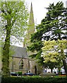
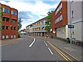
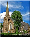
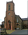
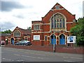
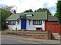
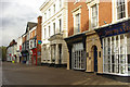
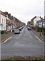
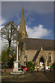
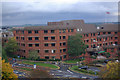
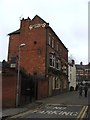
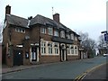
Photos of B97 4DS
Area Information
Living in B97 4DS means inhabiting a small, tightly knit residential cluster in England with a population of just 1,927. This area is characterised by its compact size and the presence of family-oriented housing, reflecting the median age of 47 and the dominance of adults aged 30–64. Daily life here is shaped by proximity to essential services, with five nearby rail stations offering connections to Redditch, Alvechurch, and Barnt Green. The area’s retail scene includes supermarkets like Farmfoods, Aldi, and Iceland, ensuring practical convenience. While the postcode does not sit within protected natural sites or areas of outstanding beauty, its low flood risk and absence of planning constraints suggest a stable environment for residential living. The community, though small, benefits from a mix of primary and secondary education options, including Trinity High School and Sixth Form Centre, which holds an Ofsted rating of ‘good’. For those seeking a quiet, manageable living space with access to transport and basic amenities, B97 4DS offers a straightforward, no-frills alternative to larger urban centres.
- Area Type
- Postcode
- Area Size
- Not available
- Population
- 1927
- Population Density
- 2360 people/km²
The property market in B97 4DS is defined by a 45% home ownership rate, with houses forming the predominant accommodation type. This indicates a market skewed towards owner-occupied properties rather than rental-focused investment. The small population and compact size of the area suggest limited housing stock, which may influence availability and competition for properties. For buyers, this means a focus on individual homes rather than larger developments or multi-unit blocks. The absence of protected natural sites or planning constraints likely simplifies the buying process, though the high crime risk may affect desirability. Given the area’s size and the dominance of houses, properties here are likely to be family homes with garden spaces, appealing to those seeking a quiet, low-density living environment. Buyers should consider the proximity to rail links and retail amenities as key selling points, while being mindful of the area’s small footprint and potential limitations in terms of expansion or redevelopment.
House Prices in B97 4DS
No properties found in this postcode.
Energy Efficiency in B97 4DS
Amenities
Schools
Residents of B97 4DS have access to a range of educational institutions, including primary and sixth-form colleges. Redditch, the Abbey High School serves as a primary school, while Heart of Worcestershire College and Trinity High School provide secondary and post-16 education. Trinity High School and Sixth Form Centre is notable for offering both primary and academy-level education, with an Ofsted rating of ‘good’ from Ofsted. This mix of school types ensures families can choose between traditional primary education and academies with distinct curricula. The presence of a sixth-form college and a sixth-form college nearby, such as Heart of Worcestershire College, adds to the area’s appeal for those seeking further education. The combination of primary, secondary, and post-16 provision supports a seamless transition through the education system, making it easier for parents to plan for the future.
| Rank | School | Type | Entry gender | Ages |
|---|
Explore more schools in this area
Go to Schools tabDemographics
The population of B97 4DS is predominantly composed of adults aged 30–64, with a median age of 47. This suggests a community of established professionals and families, rather than a younger or elderly demographic. Home ownership stands at 45%, indicating that nearly half of residents live in properties they own, while the remaining 55% may be renters or in other housing arrangements. The accommodation type is primarily houses, which aligns with the area’s small, residential character. The predominant ethnic group is White, reflecting a homogenous population profile. While no specific data on deprivation is provided, the high proportion of owner-occupied homes and the absence of protected natural sites suggest a stable, low-risk environment. However, the lack of detailed socioeconomic breakdowns means broader conclusions about quality of life remain tentative. The area’s demographic structure supports a focus on family-oriented living, with schools and local amenities playing a central role in daily life.
Household Size
Accommodation Type
Tenure
Ethnic Group
Religion
Household Composition
Age
Household Deprivation
NS-SEC
Explore more demographic insights in this area
Go to Demographics tabPlanning
Planning Constraints
- Flood RiskPremium
- Ramsar Wetland SitesPremium
- Area of Outstanding Natural BeautyPremium
- Protected Nature ReservePremium
- Protected WoodlandPremium