Area Overview for B96 6TB
Photos of B96 6TB
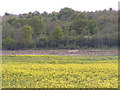
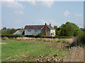
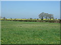
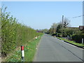
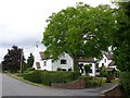
9 photos from this area
Area Information
Key information about the B96 6TB including its size, population, and administrative classification.
- Area Type
- Postcode
- Area Size
- 35.5 hectares
- Population
- 1656
- Population Density
- 66 people/km²
House Prices in B96 6TB
16
Properties
£423,722
Average Sold Price
£135,000
Lowest Price
£615,000
Highest Price
Showing 16 properties
| Address | Type | Beds | Baths | Last Sale Price | Last Sale Date | |
|---|---|---|---|---|---|---|
| The White House, Earls Common Road, Stock Green, B96 6TB | house | - | - | £570,000 | Jun 2024 | |
| Old Crown Cottage, Earls Common Road, Stock Green, B96 6TB | Detached | 5 | 2 | £615,000 | Nov 2020 | |
| Beckwood, Earls Common Road, Stock Green, B96 6TB | Bungalow | 3 | 2 | £525,000 | Nov 2019 | |
| Wysche, Earls Common Road, Stock Green, B96 6TB | house | - | - | £502,000 | Feb 2016 | |
| Walnut Cottage, Earls Common Road, Stock Green, B96 6TB | house | 4 | - | £472,500 | Sep 2012 | |
| Cherry Trees, Earls Common Road, Stock Green, B96 6TB | Bungalow | - | - | £247,000 | Aug 2011 | |
| Ashcroft, Earls Common Road, Stock Green, B96 6TB | house | - | - | £477,000 | Apr 2010 | |
| Colverdale, Earls Common Road, Stock Green, B96 6TB | Detached | - | - | £270,000 | Oct 2001 | |
| Netherwood, Earls Common Road, Stock Green, B96 6TB | Detached | - | - | £135,000 | Feb 1996 | |
| The Flat, Walnut Cottage, Earls Common Road, Stock Green, B96 6TB | Flat | - | - | - | - |
Page 1 of 2
Energy Efficiency in B96 6TB
Amenities
Schools
| Rank | School | Type | Entry gender | Ages |
|---|
Explore more schools in this area
Go to Schools tabDemographics
Household Size
Two person
most common
Accommodation Type
Houses
most common
Tenure
85
majority
Ethnic Group
White
most common
Religion
N/A
most common
Household Composition
N/A
most common
Age
47
median
Adults (30-64 years)
most common
Household Deprivation
N/A
with no deprivation
NS-SEC
44
in Lower managerial occupations
Explore more demographic insights in this area
Go to Demographics tabPlanning
Planning Constraints
- Flood RiskPremium
- Ramsar Wetland SitesPremium
- Area of Outstanding Natural BeautyPremium
- Protected Nature ReservePremium
- Protected WoodlandPremium