Area Overview for B96 6NA
Photos of B96 6NA
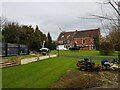
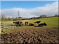
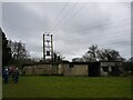
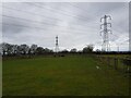
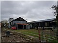
30 photos from this area
Area Information
Key information about the B96 6NA including its size, population, and administrative classification.
- Area Type
- Postcode
- Area Size
- 16.0 hectares
- Population
- 1656
- Population Density
- 66 people/km²
House Prices in B96 6NA
14
Properties
£466,750
Average Sold Price
£275,000
Lowest Price
£645,000
Highest Price
Showing 14 properties
| Address | Type | Beds | Baths | Last Sale Price | Last Sale Date | |
|---|---|---|---|---|---|---|
| 104 The Ridgeway, New End, Astwood Bank, B96 6NA | Cottage | 2 | 1 | £275,000 | Aug 2022 | |
| Tudor Lodge, 120 The Ridgeway, New End, Astwood Bank, B96 6NA | Detached | 4 | - | £645,000 | Mar 2015 | |
| 118 The Ridgeway, New End, Astwood Bank, B96 6NA | Detached | 4 | - | £575,000 | Mar 2015 | |
| Yew Tree Cottage, 98 The Ridgeway, New End, Astwood Bank, B96 6NA | house | - | - | £372,000 | Mar 2005 | |
| Pine Ridge, 110 The Ridgeway, New End, Astwood Bank, B96 6NA | Detached | 4 | 2 | - | - | |
| Tall Trees, 116 The Ridgeway, New End, Astwood Bank, B96 6NA | Detached | 6 | 2 | - | - | |
| Brackenhurst, 122 The Ridgeway, New End, Astwood Bank, B96 6NA | Retail | 6 | 4 | - | - | |
| Tanglewood, 114 The Ridgeway, New End, Astwood Bank, B96 6NA | Detached | 7 | 4 | - | - | |
| Mcgettigans Veterinary Surgery At, Lissadell, 106 The Ridgeway, New End, Astwood Bank, B96 6NA | commercial | - | - | - | - | |
| Marlborough House, 108 The Ridgeway, New End, Astwood Bank, B96 6NA | Detached | - | - | - | - |
Page 1 of 2
Energy Efficiency in B96 6NA
Amenities
Schools
| Rank | School | Type | Entry gender | Ages |
|---|
Explore more schools in this area
Go to Schools tabDemographics
Household Size
Two person
most common
Accommodation Type
Houses
most common
Tenure
85
majority
Ethnic Group
White
most common
Religion
N/A
most common
Household Composition
N/A
most common
Age
47
median
Adults (30-64 years)
most common
Household Deprivation
N/A
with no deprivation
NS-SEC
44
in Lower managerial occupations
Explore more demographic insights in this area
Go to Demographics tabPlanning
Planning Constraints
- Flood RiskPremium
- Ramsar Wetland SitesPremium
- Area of Outstanding Natural BeautyPremium
- Protected Nature ReservePremium
- Protected WoodlandPremium