Area Overview for B96 6LR
Photos of B96 6LR
Area Information
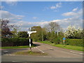
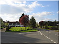
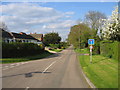
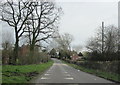
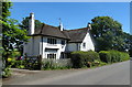
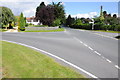
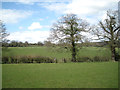
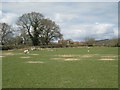
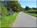
B96 6LR is a small, residential postcode area in England, encompassing a cluster of homes in a village with a population of 1,961 and a low density of 53 people per square kilometre. The area is part of the broader Sambourne civil parish in Warwickshire, historically a rural settlement that has grown into a dormitory community for nearby Redditch. Its character is defined by leafy lanes, a village green, and a Conservation Area status, reflecting its enduring environmental quality. The village retains a traditional charm, with a mix of modern and traditional properties. Residents benefit from proximity to Redditch’s amenities while maintaining a quieter, village-based lifestyle. The area’s expansion since the mid-20th century has made it a commuter hub, but its core remains rooted in rural heritage. Living in B96 6LR offers a balance of tranquillity and practical connectivity, with nearby rail links and essential services.
- Area Type
- Postcode
- Area Size
- Not available
- Population
- 1961
- Population Density
- 53 people/km²
B96 6LR is primarily an owner-occupied area, with 80% of homes owned by residents rather than rented. The accommodation type is predominantly houses, which is typical of smaller, rural postcode areas. This suggests a market focused on family homes and long-term residency rather than short-term rental properties. The area’s small size means the housing stock is limited, but the mix of traditional and modern properties offers variety. For buyers, this implies a competitive market with fewer properties available, but also a stable community with established homes. The lack of flats or apartments may appeal to those seeking larger living spaces. Proximity to Redditch and rail links adds to the area’s appeal for commuters, though the village itself retains a low-density, suburban feel.
House Prices in B96 6LR
No properties found in this postcode.
Energy Efficiency in B96 6LR
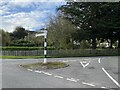
The lifestyle in B96 6LR is shaped by its village character, with a village green and leafy lanes contributing to a sense of community. Nearby amenities include five retail stores, such as Morrisons and Aldi, offering convenience for daily shopping. The area’s rail links provide easy access to Redditch and beyond, supporting both local and regional travel. The Conservation Area status adds to the area’s appeal, preserving its historical and environmental qualities. Residents can enjoy a mix of rural tranquillity and practical connectivity, with parks and open spaces nearby. The presence of schools, shops, and transport options ensures a balanced lifestyle, combining the benefits of a small village with the necessities of modern living.
Amenities
Schools
The schools near B96 6LR include Skilts School, a special school, and two Coughton CofE Primary Schools, along with Mappleborough Green CofE Primary School, which has a good Ofsted rating. This mix of primary and special schools caters to a range of educational needs, from early years to specialist provision. The presence of two primary schools in the area suggests a strong local education network, though families may need to consider travel times for secondary education. The good rating at Mappleborough Green indicates a reliable option for primary schooling. For prospective homebuyers, the availability of schools is a key factor, particularly for families with children. The area’s schools reflect the community’s focus on education and its role as a commuter settlement.
| Rank | School | Type | Entry gender | Ages |
|---|
Explore more schools in this area
Go to Schools tabDemographics
The population of B96 6LR has a median age of 47, with the majority of residents falling in the 30-64 age range. This suggests a community of established adults, many of whom may be homeowners. Home ownership is high, at 80%, with the predominant accommodation type being houses rather than flats. The ethnic composition is predominantly White, reflecting the area’s demographic profile. The low population density indicates a spread-out, possibly suburban or semi-rural layout. While no specific deprivation data is provided, the high home ownership rate and age demographics imply a stable, long-term resident base. For families, the presence of primary schools and a special school nearby aligns with the needs of the adult population. The area’s character is shaped by its older residents and the historical roots of Sambourne as a farming community.
Household Size
Accommodation Type
Tenure
Ethnic Group
Religion
Household Composition
Age
Household Deprivation
NS-SEC
Explore more demographic insights in this area
Go to Demographics tabPlanning
Planning Constraints
- Flood RiskPremium
- Ramsar Wetland SitesPremium
- Area of Outstanding Natural BeautyPremium
- Protected Nature ReservePremium
- Protected WoodlandPremium