Area Overview for B96 6LF
Photos of B96 6LF
Area Information
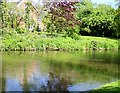
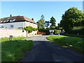
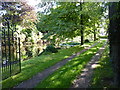
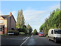
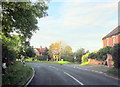
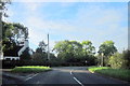
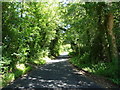
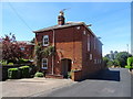
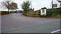
Living in B96 6LF, a small postcode area in Worcestershire, means being part of a compact residential cluster with a population of 1,500 people spread over a density of 836 per square kilometre. Nestled in the Feckenham parish near the Warwickshire border, this area is historically tied to Astwood Bank, a village with roots in the needle-making industry of the 19th century. Its proximity to Redditch, just 3.5 miles north, and nearby villages such as Studley and Feckenham offers a blend of rural charm and accessible town amenities. Daily life here is shaped by a close-knit community, with the Church of St. Matthias & St. George standing as a notable landmark. The area’s small size means residents are likely to know their neighbours, while its location provides easy access to regional transport links and local services. For those seeking a quieter lifestyle with historical character, B96 6LF offers a snapshot of traditional English village life, balanced with modern convenience.
- Area Type
- Postcode
- Area Size
- Not available
- Population
- 1500
- Population Density
- 836 people/km²
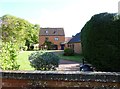
The property market in B96 6LF is characterised by high home ownership, with 85% of properties occupied by their owners. This contrasts with rental markets, indicating a community prioritising long-term investment over short-term tenancy. The predominant accommodation type is houses, which are more common than flats or apartments. Given the area’s small size and limited development, the housing stock is likely to be tightly held, with limited new builds. For buyers, this means competition for existing properties, particularly family homes suited to the area’s demographic. The focus on houses may appeal to those seeking space and privacy, though the small postcode area means buyers must consider nearby villages like Redditch or Feckenham for broader options. The market’s stability, supported by low crime and flood risk, adds to its appeal for those seeking secure, long-term residency.
House Prices in B96 6LF
No properties found in this postcode.
Energy Efficiency in B96 6LF
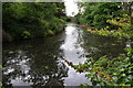
Residents of B96 6LF benefit from nearby retail and transport hubs, including five notable stores such as Morrisons Daily, Co-op Redditch, and Tesco Redditch. These shops provide everyday essentials, reducing the need to travel further for groceries or household items. The three nearby railway stations—Redditch, Bromsgrove, and Alvechurch—enhance accessibility, connecting the area to broader networks. While the data does not list parks or leisure facilities directly, the proximity to Astwood Bank’s historic church and surrounding villages suggests opportunities for walking, cycling, or visiting local attractions. The combination of retail convenience, rail access, and historical sites creates a lifestyle that balances practicality with a touch of tradition, ideal for those seeking a self-contained yet connected community.
Amenities
Schools
Residents of B96 6LF have access to two primary schools: Astwood Bank First School and Astwood Bank Primary School, both serving the local community. The latter holds a ‘good’ Ofsted rating, reflecting its quality of education and management. These schools cater to younger families, offering a range of early years and primary education. The presence of two primary schools within the area reduces the need for long commutes, a benefit for parents balancing work and family life. While no secondary schools are listed, the proximity to Redditch—just 3.5 miles north—means students can access comprehensive secondary education in the town. The mix of schools ensures a focus on foundational education, though parents may need to look beyond the immediate postcode for broader academic opportunities.
| Rank | School | Type | Entry gender | Ages |
|---|
Explore more schools in this area
Go to Schools tabDemographics
The community in B96 6LF is predominantly composed of adults aged 30–64, with a median age of 47. This suggests a mature population, likely with established careers and family ties. Home ownership is high, with 85% of residents owning their homes, indicating a stable and long-term resident base. The accommodation types here are primarily houses, reflecting a preference for detached or semi-detached properties over flats. The predominant ethnic group is White, which aligns with broader demographic trends in the region. With no specific data on deprivation, the area’s high home ownership and age profile suggest a community focused on security and continuity. However, the absence of detailed diversity metrics means the full range of cultural or socioeconomic factors influencing quality of life remains unexplored.
Household Size
Accommodation Type
Tenure
Ethnic Group
Religion
Household Composition
Age
Household Deprivation
NS-SEC
Explore more demographic insights in this area
Go to Demographics tabPlanning
Planning Constraints
- Flood RiskPremium
- Ramsar Wetland SitesPremium
- Area of Outstanding Natural BeautyPremium
- Protected Nature ReservePremium
- Protected WoodlandPremium