Area Overview for B96 6HQ
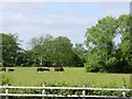
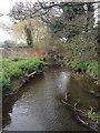
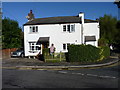
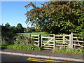
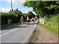
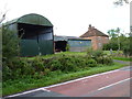
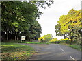
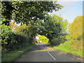
Photos of B96 6HQ
Area Information
Living in B96 6HQ means inhabiting a small, tightly knit residential cluster in Worcestershire, just 4 miles from Redditch and 11 miles from Worcester. The area’s population of 1,307, spread across 63 people per square kilometre, reflects a quiet, low-density community. Historically, Feckenham, the village associated with this postcode, sits on the ancient Saltway, a Roman road that once linked Alcester and Droitwich. Its past as the administrative heart of a royal forest adds a layer of historical intrigue, with remnants like St. John the Baptist Church and a moated site marking the former forest courthouse. Daily life here is likely slow-paced, with a focus on local amenities and a strong sense of place. The proximity to Redditch, a town with retail and transport hubs, balances the village’s rural charm with modern convenience. For those seeking a blend of heritage and practicality, B96 6HQ offers a snapshot of England’s quieter, more traditional landscapes.
- Area Type
- Postcode
- Area Size
- Not available
- Population
- 1307
- Population Density
- 63 people/km²
The property market in B96 6HQ is characterised by high home ownership (85%) and a focus on houses, indicating a predominantly owner-occupied area with limited rental activity. This suggests a community of long-term residents rather than transient tenants. The small population and low density mean the housing stock is likely limited to individual properties, with little scope for large-scale development. For buyers, this translates to a niche market where properties are likely to be family homes with established gardens or land. The absence of flats or apartments means the area may appeal to those seeking space and privacy. However, the small size of the postcode cluster implies that property choices are restricted to a few options, requiring buyers to consider nearby areas for broader options.
House Prices in B96 6HQ
No properties found in this postcode.
Energy Efficiency in B96 6HQ
The lifestyle in B96 6HQ is shaped by its proximity to small retail hubs and rail stations. Within practical reach, residents can access five retail outlets, including major names like Morrisons Daily, Co-op Redditch, and Tesco Redditch, ensuring everyday shopping needs are met. The area’s rail links to Redditch and Bromsgrove stations provide access to broader transport networks, facilitating travel to nearby towns and cities. While the data does not mention parks or leisure facilities, the historical and architectural features of Feckenham, such as its conservation area and ancient roads, suggest a setting where outdoor activities might be possible in nearby green spaces. The combination of local shops and rail access creates a convenient, if modest, lifestyle for those prioritising practicality over luxury.
Amenities
Schools
Residents of B96 6HQ have access to two primary schools: Feckenham CofE First School and Feckenham CofE Primary School, both of which cater to younger children. The latter has an Ofsted rating of ‘good’, indicating a satisfactory standard of education. The presence of two primary schools within the area suggests a focus on local schooling, which is beneficial for families with young children. However, no secondary schools are listed in the data, meaning students may need to travel to nearby towns like Redditch or Worcester for further education. The mix of schools is limited to primary levels, which could be a consideration for families planning long-term in the area.
| Rank | School | Type | Entry gender | Ages |
|---|
Explore more schools in this area
Go to Schools tabDemographics
The community in B96 6HQ is predominantly middle-aged, with a median age of 47 and the largest age group being adults aged 30–64. Home ownership is high, with 85% of properties owned by residents, and the accommodation type is overwhelmingly houses, suggesting a preference for standalone homes over flats. The predominant ethnic group is White, reflecting the area’s historical and cultural continuity. The population density of 63 people per square kilometre indicates a spacious, low-rise settlement. While no data on deprivation is provided, the high home ownership and age profile suggest a stable, mature community with established roots. This demographic profile aligns with a lifestyle prioritising privacy, property investment, and a connection to local history.
Household Size
Accommodation Type
Tenure
Ethnic Group
Religion
Household Composition
Age
Household Deprivation
NS-SEC
Explore more demographic insights in this area
Go to Demographics tabPlanning
Planning Constraints
- Flood RiskPremium
- Ramsar Wetland SitesPremium
- Area of Outstanding Natural BeautyPremium
- Protected Nature ReservePremium
- Protected WoodlandPremium