Area Overview for B96 6HN
Photos of B96 6HN

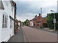
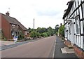
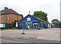
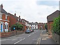
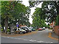
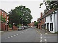
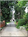
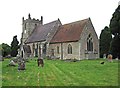
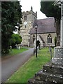
100 photos from this area
Area Information
Key information about the B96 6HN including its size, population, and administrative classification.
- Area Type
- Postcode
- Area Size
- 1.0 hectares
- Population
- 1307
- Population Density
- 63 people/km²
House Prices in B96 6HN
26
Properties
£364,773
Average Sold Price
£125,000
Lowest Price
£1,100,000
Highest Price
Showing 26 properties
| Address | Type | Beds | Baths | Last Sale Price | Last Sale Date | |
|---|---|---|---|---|---|---|
| 21-23 High Street, Feckenham, B96 6HN | Terraced | 3 | 2 | £387,500 | Feb 2025 | |
| 41 High Street, Feckenham, B96 6HN | Semi-detached | 6 | 3 | £1,100,000 | Jun 2021 | |
| 15 High Street, Feckenham, B96 6HN | house | - | - | £367,000 | Mar 2021 | |
| 3 High Street, Feckenham, B96 6HN | Semi-detached | 3 | 1 | £370,000 | Aug 2020 | |
| 9 High Street, Feckenham, B96 6HN | Semi-detached | - | - | £125,000 | Apr 2015 | |
| 11 High Street, Feckenham, B96 6HN | Terraced | 3 | 2 | £281,000 | Apr 2014 | |
| 5 High Street, Feckenham, B96 6HN | Semi-detached | 3 | 1 | £280,000 | Jun 2011 | |
| 37 High Street, Feckenham, B96 6HN | house | - | - | £340,000 | Dec 2009 | |
| 43 High Street, Feckenham, B96 6HN | house | - | - | £312,000 | Nov 2006 | |
| 45 High Street, Feckenham, B96 6HN | house | - | - | £275,000 | Jul 2004 |
Page 1 of 3
Energy Efficiency in B96 6HN
Amenities
Schools
| Rank | School | Type | Entry gender | Ages |
|---|
Explore more schools in this area
Go to Schools tabDemographics
Household Size
Two person
most common
Accommodation Type
Houses
most common
Tenure
85
majority
Ethnic Group
White
most common
Religion
N/A
most common
Household Composition
N/A
most common
Age
47
median
Adults (30-64 years)
most common
Household Deprivation
N/A
with no deprivation
NS-SEC
45
in Lower managerial occupations
Explore more demographic insights in this area
Go to Demographics tabPlanning
Planning Constraints
- Flood RiskPremium
- Ramsar Wetland SitesPremium
- Area of Outstanding Natural BeautyPremium
- Protected Nature ReservePremium
- Protected WoodlandPremium