Area Overview for B96 6AL
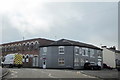
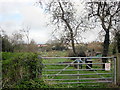
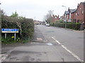
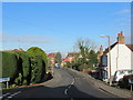
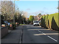
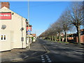
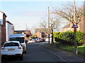
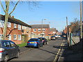
Photos of B96 6AL
Area Information
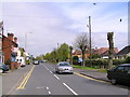
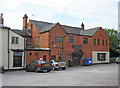
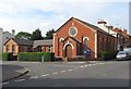
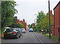
Astwood Bank is a village situated within the Feckenham parish in the Redditch district of Worcestershire. This specific postcode area covers approximately 7,582 square metres and forms a small residential cluster on the outskirts of Redditch, near the Warwickshire border. Located roughly 3.5 miles from Redditch, the area lies close to neighbouring villages such as Studley, Sambourne, Callow Hill, Feckenham, and Cookhill. Historically, this locality originated as a hamlet called Astwood on the outskirts of Redditch, initially appearing on maps alongside Crabbs Cross and Hunt End. The community experienced significant growth in the 19th century, developing rapidly due to the needle-making industry. Today, the Church of St. Matthias & St. George stands as a notable local landmark, designed in the 14th-century Decorated style and established as a chapelry of Feckenham. The village feels distinct due to its historical roots in needle factories founded in the region as far back as 1756. Living in B96 6AL offers a setting where history meets modern suburban living. The area sits within a landscape that once supported substantial manufacturing before transitioning into residential zones. Residents enjoy proximity to a rich ecclesiastical heritage, with the local church having served the community from the school since 1882 before becoming an independent parish in 1950. The demographic profile reflects a mature community, with the majority of the population falling into the working-age bracket. The small physical footprint of the postcode compared to the population suggests efficient use of space in this developed village hamlet. Homebuyers visiting the area will find a location that retains a strong connection to its industrial past while maintaining contemporary amenities nearby.
- Area Type
- Postcode
- Area Size
- 7582 m²
- Population
- 1859
- Population Density
- 3573 people/km²
The property market in B96 6AL is defined by its status as an owner-occupied enclave. The majority of homes in this postcode are privately owned, with home ownership standing at 74 percent. This statistic indicates a market where security of tenure is a priority for the majority of residents. Consequently, the rental market share is relatively small compared to newer urban developments. The accommodation type data shows that houses predominate here, which is consistent with its identity as a village within the Feckenham parish. Buyers looking at this area will find a stock highly likely to consist of family homes rather than flats or purpose-built rental blocks. The prevalence of houses and high ownership rates suggests that this is not a transient area. When purchasing homes in B96 6AL, you are entering a market where long-term residential intent is the norm. The high concentration of owner-occupiers means that tenancy rules and leasehold complexities are minimal concerns for the average buyer. The physical layout of the 7,582 square metre cluster supports single-family dwellings detached from high-density urban usage. While the specific valuation trends for individual properties are not listed in the current data, the structural market features point towards a stable environment. Homebuyers should note that entering this market often requires a significant commitment, as the 74 percent ownership rate implies that resale or sale-on-up is the standard financial pathway for residents. The housing stock reflects the historical development of the area, prioritising space and ownership history.
House Prices in B96 6AL
Showing 30 properties
| Address | Type | Beds | Baths | Last Sale Price | Last Sale Date | |
|---|---|---|---|---|---|---|
| 23 Chapel Road, Astwood Bank, B96 6AL | Semi-detached | 3 | 2 | £340,000 | Oct 2024 | |
| 9 Chapel Road, Astwood Bank, B96 6AL | Maisonette | 2 | - | £153,000 | Mar 2022 | |
| 5 Chapel Road, Astwood Bank, B96 6AL | Maisonette | 2 | - | £180,000 | Feb 2021 | |
| 17 Chapel Road, Astwood Bank, B96 6AL | Maisonette | - | - | £150,000 | Feb 2019 | |
| 7, Chapel Court, Chapel Road, Astwood Bank, B96 6AL | Maisonette | - | - | £132,800 | Apr 2015 | |
| 4, Chapel Court, Chapel Road, Astwood Bank, B96 6AL | Flat | - | - | £112,000 | Apr 2015 | |
| 1, Chapel Court, Chapel Road, Astwood Bank, B96 6AL | Semi-detached | 2 | - | £205,000 | Jul 2014 | |
| 3, Chapel Court, Chapel Road, Astwood Bank, B96 6AL | Maisonette | 1 | - | £119,000 | Oct 2013 | |
| 19 Chapel Road, Astwood Bank, B96 6AL | Maisonette | 2 | 1 | £95,000 | Aug 2013 | |
| 11 Chapel Road, Astwood Bank, B96 6AL | Flat | - | - | £120,000 | May 2013 |
Energy Efficiency in B96 6AL
Residents of B96 6AL enjoy practical access to essential amenities within a short walking or driving distance. Retail options are well represented, with five notable high street stores located nearby. You can shop at Morrisons Daily, Co-op Redditch, and Tesco Redditch, ensuring that daily grocery needs are easily met without travelling far. These supermarkets provide the variety required for both quick trips and substantial weekly shopping. Beyond retail, the area benefits from transport links that include a railway station, further enhancing the ability to commute or explore the region. The surrounding countryside, including nearby villages like Callow Hill and Cookhill, offers opportunities for outdoor activities in line with the area's rural character. The lifestyle here is shaped by a blend of village charm and modern convenience. The presence of the Church of St. Matthias & St. George adds a historical dimension to daily life, offering a focal point for the community. Residents can walk to the local historical landmarks while accessing modern retail chains just moments away. The landscape of Feckenham provides green spaces that complement the residential environment. Dining options, parks, and leisure facilities are accessible either within the village limits or in the immediate surrounding villages like Studley. This balance allows families to enjoy a quieter village life while retaining the ability to step into a more urbanised setting when needed. Your daily routine in B96 6AL will be marked by the ease of reaching essential services while remaining grounded in a community with deep roots.
Amenities
Schools
Families residing in B96 6AL have access to education facilities in the immediate vicinity. The area is served by Ridgeway Middle School and Ridgeway Secondary School, both listed as nearby options for school-age children. These institutions serve the dual role of primary and secondary education within the local catchment. Having two Ridgeway schools noted in the area suggests a dedicated educational network or a naming convention for the partnership between the two stages of schooling. The presence of these schools places the area within a practical commuting distance for families, removing the need to travel further afield for consistent education. Residents can expect a local education cluster that supports children through the transition from middle to secondary years. The mix of school types indicated by the local presence of Ridgeway schools means that parents have options that combine a continuous educational philosophy. Access to schools near B96 6AL allows residents to keep their children within the community, reducing travel time and maintaining local connections. The schools listed cater to primary and secondary age groups, ensuring that a significant portion of the resident population aged 0 to 16 years has access to structured learning. For those moving to the area, the proximity of Ridgeway Middle School and Ridgeway Secondary School is a key factor in the decision to settle in this village. The educational infrastructure supports the demographic reality of an area where adults aged 30 to 64 years form the bulk of the population.
| Rank | School | Type | Entry gender | Ages |
|---|
Explore more schools in this area
Go to Schools tabDemographics
The community in B96 6AL is characterised by a mature population structure. The median age for residents is 47 years old, indicating a neighbourhood dominated by long-term dwellers rather than young families or recent movers. Data confirms that adults between the ages of 30 and 64 years represent the most common age range within the area. This demographic skew aligns with the high level of home ownership, where 74% of households own their property outright or with a mortgage. Such a high ownership rate suggests stability and a deep-rooted community where families have established themselves over time. The predominant ethnic group in the area is White, contributing to the specific cultural fabric of this Worcestershire village. Accommodation types in B96 6AL are primarily composed of houses, fitting the profile of a village settlement rather than a high-density urban environment. With a total population of 1,859 residents concentrated across this small footprint, the density reflects a compact way of life typical of areas that evolved from local hamlets. The population density figure of 245,176 people per square kilometre highlights how tightly the community is clustered within its defined boundaries. This concentration ensures that residents live in close proximity to one another, fostering a sense of local cohesion. The age profile and ownership statistics paint a picture of a settled demographic where most residents are likely to stay put for many years. There is little turnover in the housing stock, which often leads to a stable school environment and established local networks.
Household Size
Accommodation Type
Tenure
Ethnic Group
Religion
Household Composition
Age
Household Deprivation
NS-SEC
Explore more demographic insights in this area
Go to Demographics tabPlanning
Planning Constraints
- Flood RiskPremium
- Ramsar Wetland SitesPremium
- Area of Outstanding Natural BeautyPremium
- Protected Nature ReservePremium
- Protected WoodlandPremium