Area Overview for B95 6HU
Photos of B95 6HU
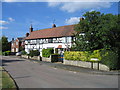
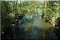
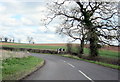
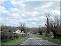
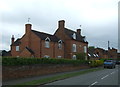
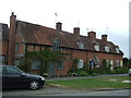
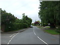
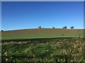
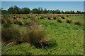
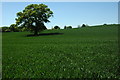
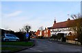
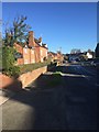
15 photos from this area
Area Information
Key information about the B95 6HU including its size, population, and administrative classification.
- Area Type
- Postcode
- Area Size
- 7.9 hectares
- Population
- 1863
- Population Density
- 56 people/km²
House Prices in B95 6HU
30
Properties
£322,382
Average Sold Price
£66,500
Lowest Price
£780,000
Highest Price
Showing 30 properties
| Address | Type | Beds | Baths | Last Sale Price | Last Sale Date | |
|---|---|---|---|---|---|---|
| 8 Chapel Lane, Aston Cantlow, B95 6HU | Terraced | - | - | £170,000 | Jan 2025 | |
| 6 Chapel Lane, Aston Cantlow, B95 6HU | Terraced | 4 | 2 | £450,000 | Mar 2023 | |
| 16 Chapel Lane, Aston Cantlow, B95 6HU | house | - | - | £430,000 | Feb 2021 | |
| 17 Chapel Lane, Aston Cantlow, B95 6HU | Bungalow | 2 | 1 | £256,500 | Sep 2019 | |
| 21 Chapel Lane, Aston Cantlow, B95 6HU | Semi-detached | 2 | 1 | £282,500 | Jul 2019 | |
| Merricott, 35 Chapel Lane, Aston Cantlow, B95 6HU | Detached | 3 | 2 | £420,000 | Jul 2018 | |
| Ardencote, 23 Chapel Lane, Aston Cantlow, B95 6HU | Bungalow | 2 | - | £335,000 | Oct 2017 | |
| Cantilupe House, Chapel Lane, Aston Cantlow, B95 6HU | Detached | 6 | 3 | £780,000 | Jan 2017 | |
| 41 Chapel Lane, Aston Cantlow, B95 6HU | Semi-detached | 3 | 2 | £370,000 | Jul 2016 | |
| 19 Chapel Lane, Aston Cantlow, B95 6HU | Bungalow | 2 | 1 | £200,000 | Aug 2013 |
Page 1 of 3
Energy Efficiency in B95 6HU
Amenities
Schools
| Rank | School | Type | Entry gender | Ages |
|---|
Explore more schools in this area
Go to Schools tabDemographics
Household Size
Two person
most common
Accommodation Type
Houses
most common
Tenure
81
majority
Ethnic Group
White
most common
Religion
N/A
most common
Household Composition
N/A
most common
Age
47
median
Adults (30-64 years)
most common
Household Deprivation
N/A
with no deprivation
NS-SEC
45
in Lower managerial occupations
Explore more demographic insights in this area
Go to Demographics tabPlanning
Planning Constraints
- Flood RiskPremium
- Ramsar Wetland SitesPremium
- Area of Outstanding Natural BeautyPremium
- Protected Nature ReservePremium
- Protected WoodlandPremium