Area Overview for B95 5SD
Photos of B95 5SD
Area Information
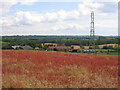
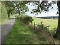
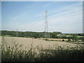
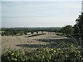
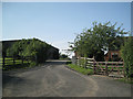
B95 5SD is a small, residential postcode area in Warwickshire, England, encompassing the village of Lapworth. With a population of 1,652 and a density of 78 people per square kilometre, it reflects a quiet, low-density settlement rooted in historical significance. Situated approximately 5 kilometres north of Henley-in-Arden and near junction 16 of the M40 motorway, the area blends rural charm with practical connectivity. Lapworth itself is a civil parish with Anglo-Saxon origins, marked by its proximity to the Grand Union Canal and the A3400 road. The village’s population is concentrated in Kingswood, near the railway station, offering a mix of historic character and modern convenience. Daily life here is shaped by its small-scale nature, with residents benefiting from nearby amenities, including retail outlets and rail links. The area’s appeal lies in its balance of seclusion and accessibility, making it suitable for those seeking a peaceful yet connected lifestyle. Its historical backdrop, including medieval hunting parks and 13th-century churches, adds depth to its contemporary appeal.
- Area Type
- Postcode
- Area Size
- Not available
- Population
- 1652
- Population Density
- 78 people/km²
The property market in B95 5SD is characterised by high home ownership (74%) and a predominance of houses as the primary accommodation type. This indicates a largely owner-occupied area with limited rental activity, typical of smaller, rural settlements. The presence of houses rather than flats or apartments suggests a focus on traditional, spacious properties, which may appeal to families or those seeking a more permanent, low-density lifestyle. Given the small size of the postcode area, the housing stock is likely limited, with properties concentrated in the village of Lapworth and surrounding clusters. Buyers should consider the area’s proximity to junction 16 of the M40 and nearby rail stations, which enhance connectivity to larger towns like Solihull and Warwick. However, the small scale of the area means that property options may be limited to existing homes rather than new developments. This makes B95 5SD more suitable for those prioritising established, historic properties over new builds or rental opportunities.
House Prices in B95 5SD
No properties found in this postcode.
Energy Efficiency in B95 5SD
The lifestyle in B95 5SD is shaped by its proximity to retail outlets and transport hubs. Within practical reach are five retail venues, including Co-op Henley-In, Heart of England Co-operative Co, and Tesco Dorridge, offering everyday shopping needs. These stores provide convenience for residents, reducing the need to travel further for groceries or essentials. The area’s rail network, with stations at Henley, Lapworth, and Danzey, connects residents to nearby towns, enabling access to broader leisure and cultural opportunities. While the data does not mention parks or recreational facilities, the village’s historical sites, such as the Church of St Mary the Virgin and nearby National Trust properties, suggest a rich cultural environment. The blend of practical amenities and historic charm contributes to a lifestyle that balances simplicity with accessibility, ideal for those seeking a relaxed yet connected community.
Amenities
Schools
The nearest school to B95 5SD is Lapworth CofE Primary School, which serves the local community with a good Ofsted rating. As a primary school, it caters to children aged 4–11, providing foundational education for young families in the area. While no secondary schools are listed in the data, the proximity to Henley-in-Arden and nearby towns may offer additional options for older students. The presence of a well-rated primary school is a key consideration for families prioritising education, though parents may need to explore further afield for secondary schooling. The school’s good rating suggests a commitment to quality teaching and facilities, which can be a significant draw for homebuyers. However, the limited number of schools in the immediate area highlights the importance of transport links to nearby towns for students requiring secondary education.
| Rank | School | Type | Entry gender | Ages |
|---|
Explore more schools in this area
Go to Schools tabDemographics
The community in B95 5SD is predominantly composed of adults aged 30–64, with a median age of 47. This suggests a stable population of middle-aged residents, likely including families and professionals. Home ownership is high, with 74% of properties occupied by their owners, indicating a long-term presence of residents. The accommodation type is primarily houses, reflecting a residential area with more spacious, traditional housing rather than flats or apartments. The predominant ethnic group is White, which aligns with the broader demographic patterns of rural Warwickshire. The low population density of 78 people per square kilometre further underscores the area’s rural character, offering a contrast to more densely populated urban centres. This demographic profile suggests a community focused on stability, with limited turnover and a strong sense of local identity. The absence of specific data on deprivation means that quality of life is inferred from the area’s amenities and safety assessments, which are generally positive.
Household Size
Accommodation Type
Tenure
Ethnic Group
Religion
Household Composition
Age
Household Deprivation
NS-SEC
Explore more demographic insights in this area
Go to Demographics tabPlanning
Planning Constraints
- Flood RiskPremium
- Ramsar Wetland SitesPremium
- Area of Outstanding Natural BeautyPremium
- Protected Nature ReservePremium
- Protected WoodlandPremium