Area Overview for B95 5NY
Photos of B95 5NY
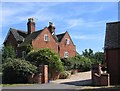
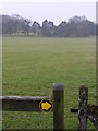
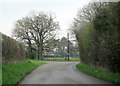
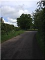
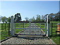
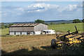
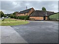

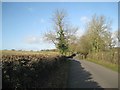
24 photos from this area
Area Information
Key information about the B95 5NY including its size, population, and administrative classification.
- Area Type
- Postcode
- Area Size
- 85.2 hectares
- Population
- 1961
- Population Density
- 53 people/km²
House Prices in B95 5NY
10
Properties
£621,875
Average Sold Price
£53,500
Lowest Price
£1,800,000
Highest Price
Showing 10 properties
| Address | Type | Beds | Baths | Last Sale Price | Last Sale Date | |
|---|---|---|---|---|---|---|
| April House, Redditch Road, Oldberrow, B95 5NY | Detached | 6 | 5 | £1,800,000 | Jan 2019 | |
| Wayside, Redditch Road, Ullenhall, B95 5NY | Detached | 4 | - | £394,000 | Apr 2002 | |
| White Gates, Redditch Road, Ullenhall, B95 5NY | Bungalow | 5 | - | £240,000 | Jul 1997 | |
| Elm Lodge, Redditch Road, Ullenhall, B95 5NY | Detached | - | - | £53,500 | Sep 1995 | |
| Aibrean Grange, Redditch Road, Oldberrow, B95 5NY | Detached | 4 | 4 | - | - | |
| Moonlake Lodge, Tracy Oaks Farm, Redditch Road, Oldberrow, B95 5NY | Detached | - | - | - | - | |
| Mobile Home, The Old Stables, Redditch Road, Oldberrow, B95 5NY | Mobile Home | - | - | - | - | |
| St Francis Group Ltd, April Barns, Redditch Road, Oldberrow, B95 5NY | Office | - | - | - | - | |
| The Old Stables, Redditch Road, Oldberrow, B95 5NY | Equestrian | - | - | - | - | |
| Barn 1 To 4, Tracy Farm, Redditch Road, Oldberrow, B95 5NY | office_workshop | - | - | - | - |
Energy Efficiency in B95 5NY
Amenities
Schools
| Rank | School | Type | Entry gender | Ages |
|---|
Explore more schools in this area
Go to Schools tabDemographics
Household Size
Two person
most common
Accommodation Type
Houses
most common
Tenure
80
majority
Ethnic Group
White
most common
Religion
N/A
most common
Household Composition
N/A
most common
Age
47
median
Adults (30-64 years)
most common
Household Deprivation
N/A
with no deprivation
NS-SEC
46
in Lower managerial occupations
Explore more demographic insights in this area
Go to Demographics tabPlanning
Planning Constraints
- Flood RiskPremium
- Ramsar Wetland SitesPremium
- Area of Outstanding Natural BeautyPremium
- Protected Nature ReservePremium
- Protected WoodlandPremium